Time Walk
Along the Edge of a Vanished Marsh


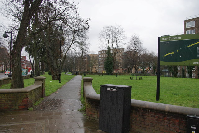
This lane was once too wet to cross easily, named for the marsh it was cut through. Walking it today, you pass Regency villas with porches and verandahs behind small gardens, a gate into Brockwell Park, and a corner pub that has changed its name twice in recent memory.
Beneath the stucco fronts lies an older story of enclosure: the lane was cut through common land in 1806 and only later took the watery name it still carries.
Name Origin
From Cross Road to Watery Lane
The lane was formerly known as Cross Road, one of the first roads cut across Rush Common following an Act of 1806. It was later called Water Lane, or Watery Lane, a name that — together with the nearby Rush Common and Rushey Green — points to marshy ground in this part of Brixton.
The lane was later straightened at its western end. That straightened stretch became Dulwich Road, while the name Brixton Water Lane was kept for the remainder. The sources used here do not explain exactly when "Brixton" was added to distinguish it from other Water Lanes.
History
Villas on Blades's Land
Building here followed the 1806 enclosure by a few years. Effra Road, running from Coldharbour Lane down to Brixton Water Lane, was formed in 1810 as part of the same enclosure of Rush Common.
The row of small two-storey terrace houses at Nos. 56–66 went up between 1816 and 1823 on land John Blades had bought in 1819–20. Each house had its own character: No. 58, once Sussex Cottage, and No. 56, once Kent Lodge, both had porches with Tuscan-type columns, though the one at No. 56 is now mutilated. No. 60, formerly Olive Lodge, carries a verandah on slender iron columns across its ground floor, while No. 64, once Norwood Cottage, has a trelliswork verandah with wreaths worked into its design. No. 62 has a porch of columns supporting a decorated top, and No. 66 is more plainly detailed, with bay windows flanking its porch. Several of these villas, along with Nos. 55 and 57, kept their stuccoed fronts when they were protected as listed buildings.
Nos. 46 and 48, once called Bayham Cottage and Meadow View, came later, built between 1830 and 1839 on land that had belonged to William Winter rather than Blades. This semi-detached pair echoes the design Papworth used for the larger houses of Brockwell Terrace.
By 1870 trams were running from Westminster Bridge Road and Kennington Road as far as the junction of Brixton Hill and Brixton Water Lane, linking this once-marshy lane into the wider tram network reaching into central London.
Culture
The Statesman on the Corner
People
George Canning's Short-Lived Premiership
George Canning (1770–1827) gave his name to the corner pub, though he had no personal connection to the lane itself. He served as Foreign Secretary from 1807 to 1809, directing the Battle of Copenhagen in 1807, and was wounded in a duel with Lord Castlereagh in 1809 after a cabinet rift.
He went on to be Ambassador to Portugal, President of the Board of Control, and Foreign Secretary and Leader of the House of Commons again from 1822 to 1827. He finally became Prime Minister on 12 April 1827 — and died just 119 days later, on 8 August 1827.
Today
A Gate Into Brockwell Park
Brixton Water Lane still forms part of the north-western edge of Brockwell Park, with Norwood Road, Tulse Hill and Dulwich Road completing the park's boundary. A row of modest listed houses, Nos. 56–66, backs directly onto the park along its southern side.
A pedestrian gate leads into the park where its western boundary meets the lane.
A wooden sculpture called the Giant Conker stands near the Brixton Water Lane entrance to Brockwell Park.
On the Map
Brixton Water Lane Then & Now
Frequently Asked Questions
Why is it called Brixton Water Lane?
It was first known as Cross Road when laid out under an 1806 Act enclosing Rush Common. It later became known as Water Lane, or Watery Lane, a name that points to marshy ground in the area.
What is Brixton Water Lane known for?
Its run of stuccoed Regency villas, several Grade II listed, built between 1816 and 1839, and its position along the north-western edge of Brockwell Park, which it borders along with Norwood Road, Tulse Hill and Dulwich Road.
Is Dulwich Road connected to Brixton Water Lane?
Yes. The lane was straightened at its western end, and that straightened section became Dulwich Road, while the remainder kept the name Brixton Water Lane.