Time Walk
A road built for a bridge


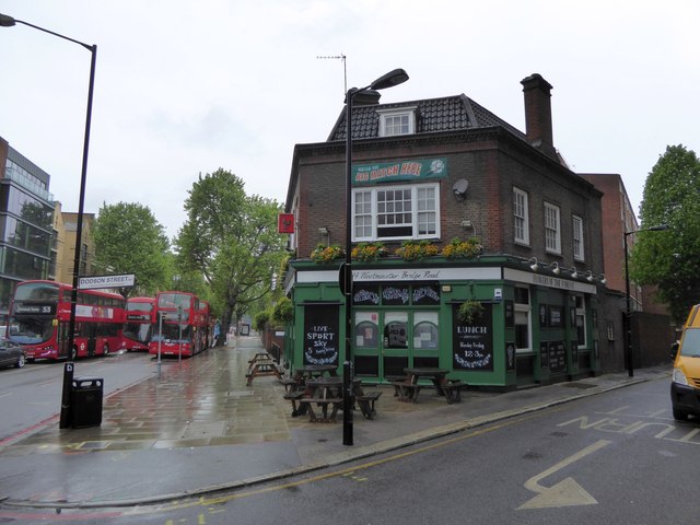
Walk the length of Westminster Bridge Road today and you cross a boundary as much as a street: Wikipedia's account notes it runs through the northern extremities of both Lambeth and Southwark. It begins as an eighteenth-century engineering project, land bought piece by piece to give the new Westminster Bridge somewhere to land on the south bank. It becomes, by the mid-nineteenth century, a strip of music halls and amphitheatres pulling in crowds from across the river. By the twentieth it has swallowed a Tube station, survived a funeral railway's bombing, and quietly housed Britain's foreign intelligence service behind an anonymous office façade. Few London roads carry quite so much unremarked history along a single straight line.
Name Origin
Built to serve the bridge it is named for
The name is about as literal as London street-naming gets: Westminster Bridge Road exists because Westminster Bridge needed a way for traffic to reach it from the south. Between 1740 and 1746, Wikipedia's account records, the Commissioners of Westminster Bridge bought land from the Archbishop of Canterbury and further ground in Lambeth Marsh from the Lord Mayor and Commonalty of the City of London specifically to create this southern approach — marking, in effect, the start of the road as a distinct route.
That early acquisition was only the beginning. The Survey of London's volume on St George's Fields records that the road was formally constructed under an Act of Parliament passed in April 1769, as part of a wider scheme of approach roads connected to Blackfriars Bridge. The Act prescribed a generous width of 80 feet, and the design was entrusted to Robert Mylne, surveyor to the Blackfriars Bridge Committee. Labour and gravel for the new carriageway were contracted in June 1769, the Survey notes, at an estimated cost of £15,000 — a considerable sum for a single stretch of road, reflecting the scale of the crossing it was built to serve.
History
From marshland approach to metropolitan artery
Once Westminster Bridge itself opened, traffic along the new approach road increased sharply, the Survey of London notes — the road's whole purpose, after all, was to carry that traffic south into St George's Fields. Development followed the traffic. An Act of 1810 tried to shape what was built along the frontages crossing St George's Fields, specifying that no houses "inferior to the third building rate" should be erected there, an attempt to keep the new road respectable as the surrounding marshland was built over.
Institutions arrived early. The Royal Freemasons' School for Girls opened in temporary buildings on the site of the present No. 28, on the road's north side, in 1788, according to the Survey of London, before moving into permanent premises. It remained there until 1852, when the school relocated to Wandsworth. Meanwhile the road kept growing outward: by 1820 a new 70-foot approach road had been completed from the southern end of Strand (Waterloo) Bridge to meet Westminster Bridge Road just west of St George's Circus, tying the area's bridge approaches into a single network.
The Victorian era brought entertainment. The Canterbury Music Hall opened at 143 Westminster Bridge Road in 1852, and Gatti's-in-the-Road followed opposite it in 1865, while Astley's Amphitheatre, an older presence at 225 Westminster Bridge Road dating to 1773, burned and was rebuilt more than once before final demolition in 1893. Transport modernised the street again in the twentieth century: what became Lambeth North Underground station opened at a junction on the road in 1906, initially named Kennington Road, and the London Necropolis Railway rebuilt its city terminus here in 1902. War then reshaped the street violently — the Necropolis station was bombed in the Blitz in 1941, and the Canterbury Music Hall was destroyed in 1942.
From 1964 to 1994, the unremarkable office block at 100 Westminster Bridge Road, known as Century House, secretly served as the headquarters of Britain's Secret Intelligence Service, MI6, before being converted into ordinary residential flats in 2001.
"inferior to the third building rate"Act of Parliament, 1810
Culture
Music halls, an amphitheatre, and a memorial tower
For a stretch of the nineteenth century, Westminster Bridge Road was as much an entertainment district as a thoroughfare. The Canterbury Music Hall at No. 143 and Gatti's-in-the-Road directly opposite it drew crowds facing each other across the traffic, while Astley's Amphitheatre at No. 225 had been staging spectacle since 1773, surviving repeated fires and rebuilds before its final demolition in 1893. Gatti's itself later became a cinema, Wikipedia's account notes, before wartime damage led to its demolition in 1950.
Close to the junction with Kennington Road stands the Lincoln Memorial Tower, built in the late nineteenth century by Christopher Newman Hall in memory of Abraham Lincoln and the Emancipation Proclamation — an unexpected transatlantic monument on a South London approach road. Education and worship sit alongside this history: Morley College, an adult education college, and its associated Morley Gallery are both on the road, and St George's Cathedral, Southwark stands between Westminster Bridge Road and St George's Road, its diocesan offices fronting directly onto the street.
People
Engineers, showmen, and a preacher
Robert Mylne, surveyor to the Blackfriars Bridge Committee, gave Westminster Bridge Road its physical shape, designing the 80-foot carriageway authorised under the 1769 Act, according to the Survey of London — an engineer's imprint on the street that long outlasted the coaching traffic he planned for.
The road's Victorian character owed much to two rival impresarios. Charles Morton commissioned the Canterbury Music Hall at 143 Westminster Bridge Road in 1852, establishing the venue beside the existing Canterbury Tavern, and Carlo Gatti answered with Gatti's-in-the-Road opposite in 1865, Wikipedia's account records — a direct competition for audiences played out across the width of a single street.
Christopher Newman Hall left a different kind of mark, building the Lincoln Memorial Tower near the Kennington Road junction in the late nineteenth century in memory of Abraham Lincoln and the Emancipation Proclamation, a monument that still stands as an unusual piece of American history embedded in a Southwark and Lambeth road.
Recent Times
From spies to flats
The street's most secretive chapter ran from 1964 to 1994, when the office block at 100 Westminster Bridge Road, known as Century House, served as the headquarters of the UK's Secret Intelligence Service, MI6, according to Wikipedia's account — an anonymous building doing work far removed from its outward appearance. Once the service relocated, Century House was refurbished and converted in 2001 into the Perspective Building, a residential development designed by Assael Architecture, converting Cold War infrastructure into ordinary flats.
Other institutions have since moved on too: the Overseas Development Institute kept its office on Westminster Bridge Road until 2019, when it relocated to Blackfriars Road. Older layers of the street's history remain visible if easy to miss — the entrance of the London Necropolis Railway's terminus, bombed in 1941, still stands at 121 Westminster Bridge Road, a surviving fragment of a station built to carry funeral traffic out of London.
Today
A boundary road with layered history
Westminster Bridge Road today still marks the meeting point of Lambeth and Southwark, as Wikipedia's account notes, its junction at Lambeth North station — once nicknamed Asylum Circus for its proximity to the Bethlem Royal Hospital, which occupied what is now the Imperial War Museum from 1815 to 1930 — still a recognisable local landmark. At its western end sits the Florence Nightingale Museum, within the grounds of St Thomas' Hospital, while further along, Morley College and its gallery, St George's Cathedral, and the surviving Necropolis Railway entrance at No. 121 keep the road's varied institutional past visible amid its later residential conversions.
On the Map
Westminster Bridge Road Then & Now
Frequently Asked Questions
Why is it called Westminster Bridge Road?
It was built specifically as the southern approach to Westminster Bridge. Land was bought for the purpose between 1740 and 1746, and the road was formally laid out under an Act of Parliament in 1769, designed by Robert Mylne, the Blackfriars Bridge Committee's surveyor.
What is Westminster Bridge Road known for?
It's known for its Victorian entertainment history — the Canterbury Music Hall and Gatti's-in-the-Road faced each other across the street — and for later housing MI6's headquarters at Century House from 1964 to 1994, now converted into residential flats.
Does anything survive of the London Necropolis Railway on the road?
Yes. The Necropolis Railway rebuilt its terminus on Westminster Bridge Road in 1902, but it was bombed in the Blitz in 1941 and subsequently closed. The station entrance itself still stands at 121 Westminster Bridge Road.