Time Walk
Where Clapham Began


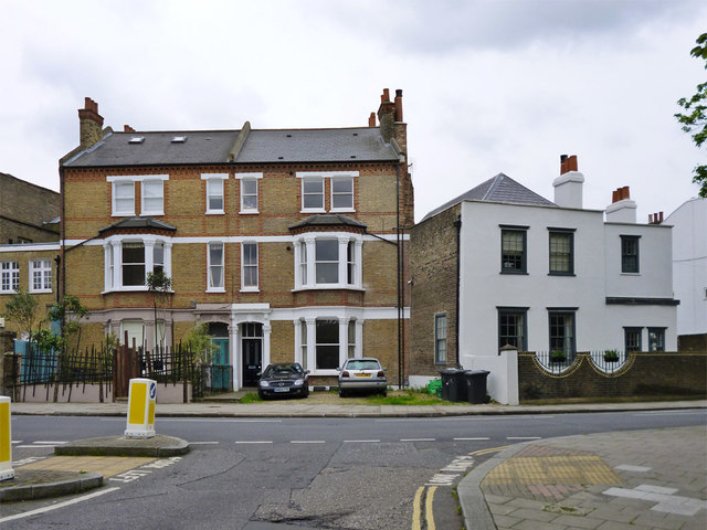
Before Clapham became a byword for the suburban commuter, this short street was the whole village. Walking it today, a visitor passes Georgian terraces, a late-Victorian pub front and a scatter of quietly protected houses. The street sits on raised ground above the old Thames floodplain.
Underneath the brick fronts is a settlement that was once tiny. That older Clapham, and the rectory that stood among it, gave this street its name.
Name Origin
The Priest's House on the Grove
Rectory Grove takes its name directly from the rectory, the residence of the parish priest, which once stood near here. According to the Victoria County History of Surrey (1912), it was this building that gave the present street its name. The old parish church itself stood a little to the north-west of the road to London — the present High Street — close to where St Paul's Church now stands.
History
The Lost Village of Clapham
This was Clapham before Clapham spread. The medieval village was centred on what are now Rectory Grove, North Street and Turret Grove, clustered around the old parish church. In 1332 the whole settlement counted only eighteen taxpaying inhabitants. Nearby, the Nags Head public house stood at the corner of North Street and Wandsworth Road, marked on a map of 1828.
The street's oldest surviving buildings reach back further than its grander 19th-century growth. No. 2, a late 18th-century house paired with No. 94 Larkhall Rise, and the early-to-mid 18th-century pair at Nos. 8 and 10, pre-date the wider development. Most of the surrounding area, including Clapham Manor Street, was built up between 1837 and 1855. In July 1986 the conservation area covering Rectory Grove was extended to take in 41–63 Larkhall Rise.
No. 6 Rectory Grove, an early 19th-century protected building of just two floors and three windows, is thought to have once served as a watch house.
Recent Times
Workshops Behind the Terraces
Not every building here stayed residential. Behind its front at No. 47a, a 1950s record describes an engineering works, after a spell as Protected Metals Ltd., electro-metallurgists, and earlier still as A.J. Smith, disposers of Government surplus stock. Next door at No. 49a, the 1950s use was a printing works; in the early 1960s it housed Thermo Acoustic Products Ltd., and in the 1930s it had been the French Cigarette Paper Co.
Today
A Street of Listed Fronts
Much of what stands on Rectory Grove today is protected. The early-to-mid 19th-century terrace at Nos. 12–18 stands close to the early 19th-century pairs at Nos. 51 and 53, and at Nos. 55 and 57. The pub now known as The Calf still carries its green-tiled Queen Anne front from its c.1880 rebuilding.
On the Map
Rectory Grove Then & Now
Frequently Asked Questions
Why is it called Rectory Grove?
It takes its name from the rectory, the house of the parish priest, which once stood nearby close to the old parish church.
What is Rectory Grove known for?
It was the centre of the medieval village of Clapham, recorded with only eighteen taxpaying residents in 1332, and it still holds several Grade II listed 18th- and 19th-century houses.
How old are the buildings on Rectory Grove?
The oldest surviving houses, Nos. 8 and 10, date from the early-to-mid 18th century and were re-fronted in the early 19th century; No. 2 is late 18th century.