Time Walk
A Flood Wall Turned Thoroughfare


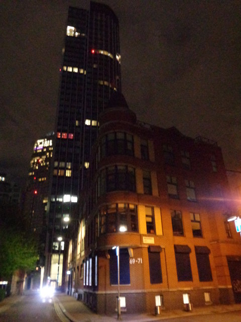
This was built to keep the Thames out, not to carry traffic — a flood wall that became one of London's trade roads. Today it runs behind the South Bank's towers, past office blocks and a converted wharf at Gabriel's Wharf.
Underneath lies a medieval causeway that once crossed open marsh, and beneath that a riverbank overgrown with rushes and willows. The name that grew out of that buried ground is where the story really starts.
Name Origin
From Narrow Wall to Upper Ground
The street began life as Narrow Wall, a medieval embankment first recorded in 1443, built parallel to the river to hold back floods and carry a causeway along the edge of the marsh.
By the Elizabethan era the river had shifted and Narrow Wall no longer fronted the water at all; it stood inland, still doing duty as a crossing through the marsh. In 1815, as part of the development of Prince's Town, Narrow Wall was widened to form Commercial Road. The road was later called Upper Ground Street before taking its present name, given because this had formerly been a raised earth ditch between the river and the Surrey marshland.
History
Timber, Glass, and Print on the Old Causeway
For centuries the ground north of the wall was unfit for building. By the 16th century the foreshore near Upper Ground was overgrown with rushes and willows, still regularly submerged at high tide, with no buildings standing on it. By the 17th century the land had been put to work as timber yards, wharves, and osier beds.
Trades clustered along the wall. A 1780 lease records the King's Old Barge House site in the tenure of Thomas Lowe & Co, glass bottle makers, and the Wood-mongers' barge house site in the tenure of Margaret Eeles and Thomas Bond, timber merchants. The 1815 widening into Commercial Road came with new connections: Stamford Street was extended to meet Waterloo Road, and Duchy Street and Coin Street were built to link Commercial Road with it, all part of the Prince's Meadow development.
Printing then became the dominant trade. William Clowes's works took over the site between Duchy Street and Coin Street in 1821 and remained there until the premises were bombed in 1941. Public houses stood along the street too, including the Bear & Ragged Staff at No. 67, by the junction with Hatfield Street, and the Admiral Vernon at No. 26, both recorded in 1842.
Culture
A Tower Reimagined as a Spaceship
Southbank Tower served as the headquarters of IPC Media, one of Europe's biggest publishing companies, before IPC moved to the Blue Fin Building in nearby Bankside in 2007.
People
Printers and Architects
William Clowes's printing works stood here from 1821 until it was bombed in 1941. The street's skyline changed later under Richard Seifert and Sir Denys Lasdun, architects of Southbank Tower and the IBM Building.
The Admiral Vernon public house at No. 26 Upper Ground, recorded in 1842, sometimes appears under a different name — Vernon's Head — in old Sun Fire Office insurance records.
Today
Gravel, Glass, and a Converted Wharf
Upper Ground's surface is finished in bound gravel rather than tarmac. Southbank Tower, New King's Beam House, and the IBM Building stand along it, alongside Gabriel's Wharf, which occupies the former site of the Eldorado Ice Cream Company. The street still runs its old course, from a causeway through the marsh to a working frontage behind the South Bank's towers.
On the Map
Upper Ground Then & Now
Frequently Asked Questions
Why is it called Upper Ground?
The name refers to its origin as a raised earth ditch, or causeway, between the river and the Surrey marshland. It was earlier known as Narrow Wall, then Commercial Road, then Upper Ground Street, before settling on Upper Ground.
What is Upper Ground known for?
It began as a medieval flood embankment, became a Victorian industrial road home to William Clowes's printing works, and today carries modern office buildings including Southbank Tower and the IBM Building.
What stood on Upper Ground before the modern towers?
Timber yards, wharves, osier beds, glass bottle makers, and William Clowes's large printing works, which occupied the site between Duchy Street and Coin Street from 1821 until it was bombed in 1941.