Time Walk
A Lane With No Front Doors


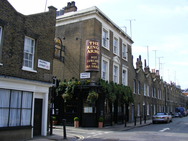
This walk once led somewhere: a church that no longer exists. No building faces onto it directly, only flank walls and garden walls, which makes it unusually quiet for a street so close to Waterloo. It widens slightly as it runs north, with views through garden walls breaking up the brick.
A painted sign at the corner still points the way it used to lead, north towards the vanished St. Andrew's Church. South, the walk continues under the railway viaduct towards The Cut. That lost church, more than any building still standing, is the thread worth following here.
Name Origin
From Open Ground to Windmill Street
The street was formerly called Windmill Street. The name is said to recall windmills that once stood on the spot, when this part of Lambeth was still countryside rather than city streets. It later became Windmill Walk, the name it carries today.
History
Bollards, a Barrier, and a Vanished Church
By the time of a 2007 council survey, Windmill Walk's history was legible mainly in its street furniture. Historic black-and-white bollards, concentrated around the walk, were singled out as adding welcome interest, and two iron bollards still marked the corner with Theed Street. Less happily, the same survey noted an unattractive concrete lamp standard and a traffic barrier crossing the walk, both judged out of keeping with the surroundings.
By then the church the sign once pointed to was already gone.
A painted sign still fixed to 61 Roupell Street once pointed walkers up Windmill Walk towards St. Andrew's Church — a building that no longer exists.
Culture
Hope on a Chimney, Legend on Location
Away from the pub, the street has had a brush with the screen: the surrounding area was used for location filming on the 2015 film Legend.
On the Map
Windmill Walk Then & Now
Frequently Asked Questions
Why is it called Windmill Walk?
The street was formerly Windmill Street, a name said to recall windmills that stood here when the area was still countryside. It later became Windmill Walk.
What is Windmill Walk known for?
It's a pedestrian cut behind Roupell Street with no buildings fronting onto it directly, historic bollards, and the Windmill Tavern, an inter-war pub, at its junction with The Cut.
Where did Windmill Walk lead?
Historically it led north towards St. Andrew's Church, marked by a surviving painted sign at 61 Roupell Street; the church itself has since been demolished.