Time Walk
A Hill Named for a Commonwealth Family


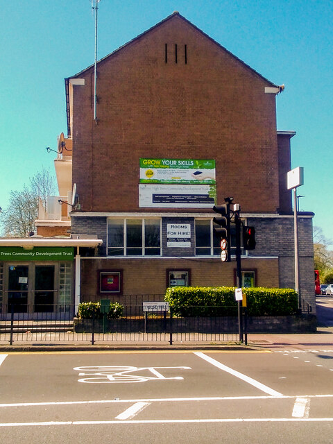
An astronomer once watched the stars from his own garden here. Today Upper Tulse Hill is a quiet residential climb of mixed housing, where a handful of early Victorian semi-detached villas still stand among later rebuilding. At the corner of Ostade Road, red brick St Matthias Church marks the street's Victorian high point.
Walk it now and little hints at how new the road once was. It was cut through farmland only in the 1820s, on an estate whose name recalled a family who had held the land since the Commonwealth. That older layer — of leases, cottages and coach-houses — sits beneath the surviving fragments, and gives the street its name.
Name Origin
From Tulse Family Land to Edwards's New Road
The name goes back to the 1650s. The Tulse family came into ownership of farmland in the area during the Commonwealth, and the hill took their name.
Upper Tulse Hill itself is younger. Dr Thomas Edwards, owner of Tulse Hill Farm, built the roads now known as Tulse Hill and Upper Tulse Hill in 1820–1, a few years after Lord Thurlow's death in 1806. An 1823 plan by Chandler and Buckingham marked them as Lower Tulse Hill Road and Upper Tulse Hill Road. The parish took the roads over as early as 1822 and abolished the tolls.
History
Villas, Leases and a Vanished Terrace
The road was built to open up Edwards's land for development, and large houses with coach-houses soon rose along it in the first half of the nineteenth century. Building progressed southwards from the west side, where most of the early houses stood, with a run of small terrace-houses added there mostly between 1843 and 1850.
The leases tell the story house by house. No. 66, a two-storey villa with wings, was granted a 99-year lease from March 1822. Nos. 92 and 94, semi-detached and stucco-fronted, went to Simon Dodd Guthrie on a 96-year lease the same year; No. 92 was once known as Eldon House. No. 100, formerly Laurel Bank, was built under an 1824 lease to William Andrews and still carries a stucco front with a Roman Doric porch. No. 122, once Nottingham Cottage and later Hollyhurst, was leased to the hat manufacturer William White in 1841 and survives with its Greek Doric porch and overhanging eaves. On the east side, Nos. 55 to 75 were built in the 1840s to a lower standard than the west.
St Matthias Church arrived late in the century. Its site, once part of the Manor of Lambeth, was bought in 1881 from the Trustees of Stockwell Orphanage. Mrs Selina Lingham laid the foundation stone on 2 June 1894; the architects were John Thomas Newman and William Jacques, the builders Messrs James Longley and Co, and the finished church seated 780 and was dedicated that December. It was consecrated on 25 March 1899, when a Consolidated Chapelry was assigned, and the parish itself was formed in 1900.
Culture
An Astronomer's Garden Observatory
People
Builders and a Hat Manufacturer
Most of the names attached to Upper Tulse Hill's houses are lessees rather than famous residents. William White, described variously as "of Tulse Hill, gentleman" and as a Cheapside hat manufacturer, took leases for Nos. 120 and 122 in the early 1840s. Daniel Wilson Davidson, a solicitor of Clement's Inn, built No. 108 under an 1830 lease, and John Gubbs, an insurance broker of Lloyds, built No. 116 in 1826.
Mrs Selina Lingham laid the foundation stone of St Matthias in 1894.
Recent Times
What the Postwar Clearances Left Behind
Most of the early villas are gone. Upper Tulse Hill was formerly lined with early nineteenth-century residences until their wholesale demolition in the immediate postwar years, and by the 1950s the smaller houses were fast disappearing as redevelopment changed the neighbourhood's character.
Nos. 43–53 Upper Tulse Hill, six attractive two-storey-with-basement semi-detached houses built in a simple late Georgian style in the 1840s, are a rare surviving group from the street's original Victorian terrace.
On the Map
Upper Tulse Hill Then & Now
Frequently Asked Questions
Why is it called Upper Tulse Hill?
It takes its name from the Tulse family, who acquired farmland here during the Commonwealth in the 1650s. The road itself was laid out on that land by Dr Thomas Edwards in 1820–21.
What is Upper Tulse Hill known for?
It is known for St Matthias Church, built in 1894 at the corner of Ostade Road, and for having been home, at No. 90, to the astronomer William Huggins's private observatory from about 1850 to 1915.
Do any of the original houses survive?
Most of the early nineteenth-century villas were demolished in the postwar years, but a small group of 1840s semi-detached houses at Nos. 43–53 survives.