Time Walk
An Older Line Beneath the Victorian Terraces


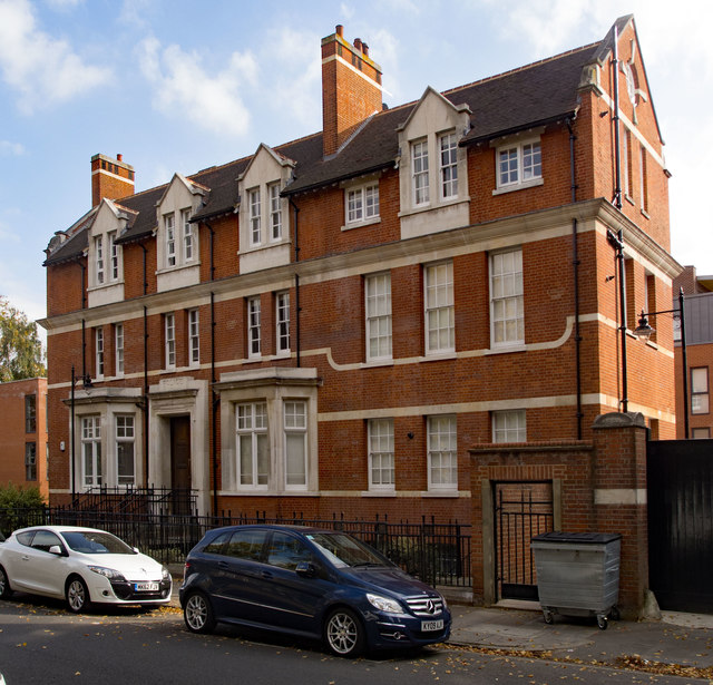
The road you are walking is older than the houses on it. Union Road follows the line of an earlier thoroughfare, laid before the regular Victorian terraces went up around it, which is why it zig-zags gently and climbs slightly as it meets Bromfelde Road.
Underneath the bay windows and dormers, this was once a boundary lane, with a pub already serving drinkers here in 1842, before the surrounding streets existed in their present form. That older, irregular shape is the first clue to understanding how the road got its name.
Name Origin
A Name the Records Do Not Explain
Union Road's neighbours were named deliberately. When architect E B I'Anson laid out the surrounding streets in 1875-76 for landowner George Hankey, he named them after figures from Clapham's history. No equivalent explanation survives for Union Road itself, and the road is older than that scheme in any case, following the line of a pre-existing thoroughfare.
History
From a Working Pub to a Rebuilt Corner
A pub called the Royal Oak stood at 110 Union Road in 1842, decades before the terraces that now define the street were built. When I'Anson came to lay out the surrounding streets for Hankey in 1875-76, Union Road's older, less regular line was already in place, and the new development simply grew up around it.
The twentieth century brought violence to the junction with Bromfelde Road. A landmine fell there on 18 September 1940, and 49-51 Union Road had to be rebuilt afterwards.
Numbers 49-51 Union Road, as they stand today, were rebuilt after a landmine fell at the Bromfelde Road junction on the night of 18 September 1940.
People
The Architect and the Landowner
Two names sit behind the streets around Union Road: E B I'Anson, the architect, and George Hankey, the landowner for whom he worked in 1875-76. Neither man is linked to Union Road's own name, only to the development that grew up alongside it.
Today
On the Line Between Clapham and Stockwell
Union Road still sits on a boundary, running along the line between Clapham and Stockwell, marked by a "Stockwell Town" sign to the north. Larkhall School stands off the road, and at the corner with Clapham Road the Phoenix pub carries ornamented stucco on its Union Road side as well as its main front.
Many of the houses here were built without basements. At 81-91 Union Road the roofs rise steeply over bay windows with inset dormers, a detail repeated along nearby Larkhall Rise. The road's gentle zig-zag and slight climb toward Bromfelde Road are still the clearest trace of the older line it has followed since before the Victorian terraces arrived.
On the Map
Union Road Then & Now
Frequently Asked Questions
Why is it called Union Road?
The sources used here do not explain the name. The surrounding streets were named after Clapham's historical figures when architect E B I'Anson laid them out in 1875-76, but no equivalent origin is recorded for Union Road, which predates that development.
What is Union Road known for?
Union Road is known for following an older, irregular line beneath its Victorian terraces, for a landmine that struck the Bromfelde Road junction in 1940, and for sitting on the historic boundary between Clapham and Stockwell.
When was Union Road first recorded?
The Royal Oak public house is recorded at 110 Union Road in 1842, decades before the surrounding streets were laid out in 1875-76.