Time Walk
A Road Carved Out of Common Land


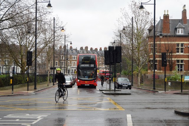
This short Brixton road exists because commissioners carved up a common in 1810 to open new land for building. Walking it today, three things stand out: tree-lined villas on either side, glimpses of St Matthew's church tower ahead, and a distinctly suburban hush. The road still ends, as it always has, at the church's doorstep.
Beneath the villas lies an older story of allotment and enclosure — this was once open common, divided and parcelled out for houses only after 1810. That origin shapes what the road is called.
Name Origin
Church Road, Then St Matthew's
An 1841 map recorded this road as Church Road. It now carries the name St Matthew's Road, shared with the parish church that stands at its southern end, where the road meets a T-junction on the church's south side. The sources used here do not explain exactly when or why the name changed from Church Road to St Matthew's Road.
The connection to the church is nonetheless close. When the Rush Common building restrictions were relaxed in 1821, the single exception allowed was for St Matthew's Church itself, together with a burial ground and parsonage house. No. 5 on the road is that parsonage: it still serves as the vicarage of St Matthew's Church.
History
From Rush Common to Parish Highway
St Matthew's Road began as an access route for new building plots. In 1810 the Lambeth Manor Inclosure Commissioners divided and allotted Rush Common and Norwood Common, providing new roads — this among them — to reach the resulting inclosures. It was approved as a parish highway in 1821, the same year building restrictions on the common were eased specifically to allow St Matthew's Church, its burial ground and a parsonage.
Building followed quickly on one side. In the 1820s Robert Stone's Trustees leased a plot between Effra Road and St Matthew's Road to William Brass, a Wood Street, Cheapside builder, who put up Nos. 1–5 between 1825 and 1827. No. 1 is a stucco villa with a Greek Doric entrance; Nos. 3 and 5 are a stock-brick pair, the latter becoming the church vicarage. Further up, William Lawrence of Hoxton built Nos. 7–21 shortly after 1840 — four pairs of stucco-fronted houses with recessed, Doric-columned porches.
Two institutions anchored the road from the start. Trinity Congregational Church had its foundation stone laid on 23 September 1828, and St Matthew's C.E. School was founded the same year. The school building grew dilapidated and was entirely rebuilt in 1871 by architect Joseph Gale to hold 600 children; its tapering north-east tower was heavily damaged during the war of 1939–45. No. 1 and Nos. 3 and 5 were first listed Grade II on 8 February 1979.
When Rush Common's strict building restrictions were relaxed in 1821, the only construction permitted on the common was St Matthew's Church itself, along with its burial ground and parsonage house — the very building that gave the road its name.
Culture
A Pleasant Brick Front of Domestic Character
The Survey of London, writing in the 1950s, called the exterior of Trinity Congregational Church "a pleasant brick front of almost domestic character."
"a pleasant brick front of almost domestic character"Survey of London, Vol. 26 (1950s)
People
Builders of the Rush Common Villas
Two builders raised the road's houses in two separate decades: William Brass in the 1820s and William Lawrence shortly after 1840.
Joseph Gale, architect, rebuilt St Matthew's C.E. School in 1871 after it had fallen into dilapidation, designing a building for 600 children.
Recent Times
A Seven-Storey Neighbour
The London County Council built the St Matthew's Road Estate in the 1950s, overlooking Rush Common. Its blocks rose seven storeys, almost as tall as St Matthew's Church itself. Layers of London describes the estate as "a drab and uninspired example of its era."
"a drab and uninspired example of its era"Layers of London, on the St Matthew's Road Estate, 1958
Today
Two Centuries Side by Side
The two sides of the road still read as two different centuries. The east side keeps its early 19th-century villas; the west side shows later Gothic-style houses from the late 19th century. The road remains tree-lined, with glimpses of St Matthew's tower giving it, as the council's own description puts it, "a pleasant suburban character." It sits within the wider open land of Rush Common, which also takes in Brixton Oval, Brixton Hill, Effra Road, St Matthew's Churchyard and Windrush Square.
On the Map
St Matthew's Road Then & Now
Frequently Asked Questions
Why is it called St Matthew's Road?
The road shares its name with St Matthew's Church, which stands at its southern end. It was recorded as Church Road on an 1841 map, but the sources used here do not explain exactly when it took its present name.
What is St Matthew's Road known for?
Its early 19th-century villas, built by William Brass and William Lawrence, two of which — No. 1 and Nos. 3 and 5 — are Grade II listed, and its role as the approach to St Matthew's Church.
When was St Matthew's Road laid out?
It was provided for in 1810 when the Inclosure Commissioners divided Rush Common, and was formally approved as a parish highway in 1821.