Time Walk
Along the Cemetery Wall


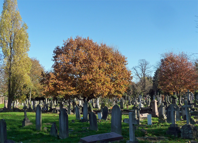
For much of its length, Robson Road has done one job: running alongside the dead. Walking it today, the eye is drawn to the cemetery's old cast-iron railings and to the former pub on the corner with Norwood Road.
Behind the railings lie sections of the cemetery more densely packed and more evocative of the archetypal Victorian burial ground than the grander avenues further in. That older, crowded landscape sits just out of sight of the pavement — which is where the street's own quieter story begins.
Name Origin
An Unexplained Name
The sources used here do not explain who or what Robson Road was named after. No naming link survives in the conservation area appraisal or the local heritage list consulted for this page.
History
Railings, a Pub and a Flood
By 1853, shrubbery had been extended along the boundary between West Norwood Cemetery's forecourt and Robson Road, following the introduction of railings around that forecourt. Those railings still mark where the cemetery meets the street.
On the corner with Norwood Road, at No. 551, stands a pub known as the Jack Stamp, dating from the late 19th century. It carries polished pink granite pillars from its original build and steel windows added between the wars.
On 14 June 1914, a thunderstorm forced the River Effra out of its sewer, flooding Robson Road along with Ernest Street, East Place, Auckland Place, Wood Street, Dunbar Street and Chestnut Road.
On 14 June 1914 a thunderstorm forced the buried River Effra back up out of its sewer, sending it across Robson Road and six neighbouring streets.
Today
Still Walled by Victorian Iron
The old railings along Robson Road still give the street its most striking feature, with the cemetery behind them still more densely packed and evocative than its grander sections. The corner pub, the former Jack Stamp, remains on the junction with Norwood Road.
On the Map
Robson Road Then & Now
Frequently Asked Questions
Why is it called Robson Road?
The sources used here do not explain the origin of the name. No naming record appears in the conservation area appraisal or local heritage list consulted.
What is Robson Road known for?
Robson Road runs beside the mid-19th century boundary railings of West Norwood Cemetery and has a former corner pub, the Jack Stamp, dating from the late 19th century.
Did Robson Road ever flood?
Yes. On 14 June 1914, the River Effra burst from its sewer during a thunderstorm and flooded Robson Road along with several neighbouring streets.