Time Walk
A Lane That Kept Its Shape


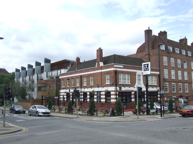
Larks are said to explain this lane's name, caged by a long-forgotten tavern-keeper. Walk it today and you find Georgian houses sitting beside Victorian terraces, the lane feeling older and looser than the streets around it.
Beneath the mixed buildings lies one of the area's oldest road lines: Larkhall Lane appears to have existed since at least the mid 17th century. That age sits oddly with the ordinary, workaday lane you see today — which is where its name becomes worth asking about.
Name Origin
Caged Birds and a Lost House
Two explanations survive side by side, and neither is certain. One account holds that "Lark Hall" was a historic house once standing in the locality. The other says the name comes from the Lark Hall Tavern, said to honour a former licensee who kept larks in a cage.
The sources used here do not resolve which account is correct, or whether the tavern took its own name from the earlier house. Either way, the lane's modern form was already in place by the mid 17th century, well before any of the buildings now standing on it.
History
From Old Road to Conservation Area
The lane's buildings arrived in waves. Nos. 2–10 form an interesting terrace of late Georgian houses with a solid, uniform roofline. Numbers 6 and 8 are a handed pair with semi-circular windows and large central pediments, while No. 10 carries a shaped top and a pedimented porch. No. 12, an early-to-mid 19th century house of three bays, still keeps good railings at its front garden.
At the north end, close to the junction with Lansdowne Way, the Angell Arms faces onto the lane from Binfield Road — a pub first shown on a map of 1868 though perhaps built as early as the 1850s, meant from the start to stand out as a local landmark.
Further south, Nos. 88, 90, 92 and 94 form a unified terrace with spiked finials and unusual swag details. Nos. 76 and 78 are a plainer pair, two storeys over a basement, Grade II listed in 1976. In 1902 the Church of St Francis of Sales and St Gertrude was built on the lane, its east end carrying a large circular window and a tall metal cross; F. W. Tasker was probably its architect.
Recent Times
Borders Drawn and Redrawn
The conservation area around the lane has shifted shape more than once. Designated in June 1981 and extended in July 1983, it forms an L running along Lansdowne Way and Larkhall Lane. The Angell Arms was folded into it in 2001, while properties facing Wandsworth Road were moved out into a separate designation the following year.
Nearby, Larkhall Park was created on the site of damaged and demolished housing southeast of Wandsworth Road. Its creation swept away Southville Road and Courland Street, which had originally run from Wandsworth Road through to Larkhall Lane.
Today
Old Grain, Uneven Care
Lambeth's 2012 conservation area statement singles out the lane's mature trees and soft landscaping, which give much-needed greenery to an otherwise urban stretch.
Not every change has helped it. Many buildings have seen inappropriate alterations to windows, doors and boundaries, and two noticeable gaps remain: a playground behind a high chain-link fence, and the plot at No. 94b. Even so, the attractive 19th century groupings and sympathetic infill keep the lane recognisably the same old road it has long been.
Larkhall Lane may owe its name to a tavern-keeper who kept larks in a cage — though an older "Lark Hall" house in the area is an equally plausible source, and the sources used here cannot settle which came first.
On the Map
Larkhall Lane Then & Now
Frequently Asked Questions
Why is it called Larkhall Lane?
It's uncertain. Council records link the name either to a historic house called "Lark Hall" or to the Lark Hall Tavern, whose licensee was said to keep larks caged there.
What is Larkhall Lane known for?
A short Stockwell lane with roots back to the mid 17th century, Georgian terraces at its northern end, a Catholic church of 1902, and a pair of Grade II listed houses at Nos. 76–78.
How old is Larkhall Lane?
Lambeth Council's conservation area statement suggests it, along with neighbouring Lansdowne Way and Priory Grove, has existed since at least the mid 17th century.