Time Walk
A Road Built Wider Than It Needed To Be

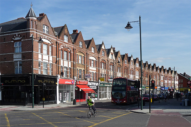
This road was deliberately built twice as wide as its neighbours, for a suburb that took decades to arrive. Today it carries detached and semi-detached houses, their styles shifting from Italianate villas to plainer Edwardian infill as you walk its length.
Beneath the settled Victorian street lies a much emptier landscape: fields, coppices and a scatter of farms, with a lord's unsold estate waiting for buyers who were slow to come. That wait, and the name a rate-book clerk gave the road before it had one of its own, is where the story of Lancaster Avenue's name begins.
Name Origin
From the New Road to Dulwich to Lancaster Avenue
Lancaster Avenue first appears by name in a plan of 1844 drawn up for building roads on the remaining parts of Lord Thurlow's Norwood estate, alongside Rosendale Road, Park Hall Road and Thurlow Park Road. The sources used here do not explain why "Lancaster" in particular was chosen for it.
Before the name settled, the road was known by other descriptions. An 1849 rate book called it "The New Road to Dulwich", and an 1854 Post Office Directory of Surrey and Sussex refers to it as Lancaster Road. It kept the name Lancaster Road until it was formally renamed Lancaster Avenue in February 1936.
The wider district took its own name from an older landscape feature: Norwood derived its name from its position on the edge of the Great North Wood, and the part nearest Lancaster Avenue was known as Lower Norwood until 1885.
"The New Road to Dulwich"1849 Rate Book
History
Knight's Hill Farm to the Blake Estate
A 1563 map of Leverhurst Manor shows this ground as fields, coppices and woodland with few buildings scattered across it. By 1745 John Rocque's map marked a cluster of buildings around the Horns Tavern to the south, and Knight's Hill Farm to the north, near where Lancaster Avenue would be laid out a century later.
Edward Thurlow, who became Lord Chancellor in 1778, gradually built up a large estate around Knight's Hill Farm. When he died in 1806 the land went up for sale, but despite its closeness to London no buyer came forward. In 1809 his trustees secured an Act of Parliament allowing them to sell or lease the land and lay out new roads to attract building.
That plan finally bore fruit in 1844, when Lancaster Avenue was one of the roads proposed, and the trustees paid £2,845 to enfranchise the remaining 156 acres of the estate. The area was sold off in freehold lots in 1845 and 1846. No. 16, built in the 1840s, is the earliest surviving house.
By 1864 much of the land was owned by Charles Blake, a City solicitor, who that year joined John Davies of Pilgrim Hill to begin developing what became the Blake Estate, later extending to Chatsworth Way, Idmiston Road and Arduli Road (then Baldstone Road). Blake built Lancaster Villas, nos. 15–31, a row of semi-detached Italianate houses, in 1864–65, and Rosemead School followed in 1865/66. A second, more modest phase without semi-basements began in 1879, and further building continued into the 1880s and 1890s. Blake died in 1897 and his estate passed to family trustees. A house-numbering system was not adopted on the street until 1885. The last houses on the corner with Arduli Road went up in 1906, and nos. 14, 14a and 14b followed in 1922, built on what had been the playground of a school at No. 16.
War reached the street in the 1940s. No. 53 was hit by bombs in October 1940, and in May 1941 bombing so badly damaged nos. 11 and 13 that they had to be demolished, leaving nos. 9 and 15 standing as detached houses. No. 12, one of the original 1860s villas, was also lost in the 1941 raid. Replacement houses were built on the damaged sites in the 1960s. In 1954–55 half the gardens of nos. 11–27 were acquired by Lambeth for the adjoining school site, and further infill followed in the late 1950s.
Lancaster Avenue was planned in 1844 at 60 feet wide, half as wide again as the 40 feet typical for roads of its time.
People
A Solicitor, a Clergyman, and a Vanished Lord
Charles Blake, a City solicitor, shaped more of this street than anyone else, owning much of the land by 1864 and developing it until his death in 1897.
Dr John William Lester, who succeeded Rev Charles Turner as incumbent of St Luke's after Turner's death in 1858, was recorded by the 1861 census as living in a house on Lancaster Road, as the street was then called. Edward Thurlow never lived to see the street that eventually rose on his estate; he died in 1806, and his land stood unsold for decades afterward.
Today
A Conservation Area of Changing Tastes
The street now stands as a conservation area, designated in October 1994. It is characterised by nineteenth-century detached and semi-detached houses that trace changing suburban tastes from the 1840s through to the 1900s, from Blake's Italianate villas to the plainer houses of his later phases. A once-unsellable estate became, in the end, a street worth protecting for exactly the variety its slow, uneven building left behind.
On the Map
Lancaster Avenue Then & Now
Frequently Asked Questions
Why is it called Lancaster Avenue?
It was named Lancaster Road when included in an 1844 plan for roads on Lord Thurlow's Norwood estate, though the sources used here do not explain why "Lancaster" was chosen. It was renamed Lancaster Avenue in February 1936.
What is Lancaster Avenue known for?
It is known for its mix of nineteenth-century villas, including Charles Blake's 1864–65 Lancaster Villas, and for being designated a conservation area in 1994 in recognition of this architectural variety.
Was Lancaster Avenue damaged in the Second World War?
Yes. No. 53 was hit by bombs in October 1940, and bombing in May 1941 destroyed nos. 11, 12 and 13, leaving nos. 9 and 15 standing as detached houses.