Time Walk
A Mile of Ordinary Business, Over Extraordinary Ground


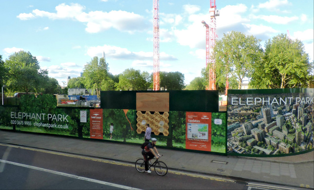
Buses grind south from the Elephant and Castle, market stalls spill off East Street, and Walworth Road does what a busy arterial road does — moves people and sells them things. Nothing about the traffic suggests that this stretch of shopfronts has, at various points, stood over an Elizabethan playhouse, hosted a Soane-designed church, and marked the birthplace of the man whose designs laid the conceptual foundation for the modern computer. The road itself is unremarkable to look at. What has happened along it is not.
Name Origin
Wealawyrth, 1006
The name Walworth is old enough to predate the road itself by the better part of a thousand years. It comes from the Saxon "Wealawyrth", a form recorded as early as 1006, meaning the farm of the serfs, or of the Britons, or of those who worked such land, per the Survey of London. The thoroughfare itself was known simply as Walworth Street in the 18th century, a name attested in 1766, before it settled into its present form as Walworth Road.
History
Before the Road
Long before Walworth Road existed as a named thoroughfare, a playhouse stood on this ground. Richard Hickes built it at Newington Butts sometime between 1566 and 1580, after taking a lease of the land from the Dean and Chapter of Canterbury in 1566. It was demolished before October 1599. Its site has been traced to a plot on the 1681 plan of the area, on the east side of what became Walworth Road near the New Kent Road junction — ground now occupied by the Reliance Building.
The road was little touched by London's growth until the mid-18th century; only after 1754, when new roads were laid out nearby, did building activity gather pace here. By 1766 a cluster of development had appeared either side of the street. In 1791, a little further along at 44 Crosby Row — now Larcom Street, at its junction with Walworth Road — Charles Babbage was likely born, an event marked today by a blue plaque at that corner.
Chapels, a Church, and Elegant Mansions
Growth accelerated sharply in the decades that followed: the population of Newington rose from 14,847 to 44,526 between 1800 and 1820, a surge that pushed both non-conformist chapel-building and the parish church to expand. St. Peter's Church, designed by Sir John Soane, went up on the east side of Walworth Road, its foundation stone laid on 2 June 1823 and the building consecrated on 28 February 1825. The Sutherland Chapel followed in 1842, built between St. Peter's and the road itself, and the Metropolitan Tabernacle at Newington Butts, designed by W. W. Pocock, cost just over £31,000. A charity school for boys, established in Newington in 1710–11, had already gained a purpose-built schoolroom and master's house at the corner of Cross Street and Walworth Road in 1775.
Writing in 1808, the topographer David Hughson captured the road at its more genteel moment.
"lined by elegant mansions"David Hughson, 1808
Traces of that period survive in the terraced houses at Nos. 104–114 (formerly Marlborough Place) and Nos. 140–152 on the west side — three-storey, flat-fronted stock-brick houses with windows set in recessed arches typical of the early 19th century. Nos. 140 and 142 are surmounted by a pediment holding an elliptical plaque of a draped woman with a garland, and both are Grade II listed, first listed on 31 January 1974, per Historic England.
Vestry Hall to Widened Road
What is now the borough's town hall began life as the vestry hall of the parish of St. Mary, Newington, officially opened on the corner of Wansey Street and Walworth Road in 1865. On its site once stood Rose Cottage, where in 1853 Harriet Beecher Stowe stayed with the Rev. Thomas Binney. The London, Chatham and Dover Railway ran parallel to the road up to Elephant and Castle station, and Walworth Road railway station itself opened in 1863 and closed in 1916 under wartime pressures. In 1891, the parish Vestry and the Trustees of the St. Mary Copyhold Estates agreed to negotiate jointly with the London County Council over widening the road, and a library opened here in 1893. Nearby, a building was demolished in 1876 to make way for the western entrance to Larcom Street. In 2016, Southwark Council designated the Walworth Road Conservation Area, formally recognising this accumulated layering, per the Southwark Council appraisal.
Long before Walworth Road existed as a named street, an Elizabethan playhouse stood on this ground at Newington Butts — built by Richard Hickes between 1566 and 1580 and demolished before October 1599. Its site has been traced to the east side of the road near the New Kent Road junction, ground now occupied by the Reliance Building.
Culture
A Florist, a Computer Pioneer, and a Museum
The road has also given its address to less famous but still specific figures. In 1792, James Maddock, a florist of Walworth, published The Florists' Directory; or Treatise on the Culture of Flowers — a small but concrete trace of the area's earlier market-garden character. Today the road's institutions include the Cuming Museum, Newington Reference Library, and John Smith House, a former Labour Party headquarters now used by the local education authority, all clustered along or near the street, per Wikipedia.
Today
Walworth's High Street
Walworth Road today is the major shopping street of Walworth, running over a mile from the Elephant and Castle to Camberwell as part of the A215. East Street Market, just off the road, is busiest on Fridays, Saturdays and Sundays. Listed Georgian terraces, the former vestry hall turned town hall, and a conservation area designated in 2016 sit alongside the ordinary business of a working high street — a road whose surface traffic gives little hint of the playhouse, the church, and the birthplaces beneath it.
On the Map
Walworth Road Then & Now
Frequently Asked Questions
Why is it called Walworth Road?
The name Walworth derives from the Saxon "Wealawyrth", recorded in 1006, meaning the farm of the serfs, Britons, or those who worked such land. The road itself was known as Walworth Street in the 18th century before becoming Walworth Road.
What stood on Walworth Road before it was built up?
A playhouse built by Richard Hickes between 1566 and 1580 stood at Newington Butts, on ground later crossed by Walworth Road near its junction with New Kent Road; it was demolished before October 1599, well before the road existed as a named thoroughfare.
What is Walworth Road known for?
Walworth Road is known today as Southwark's busy A215 high street, running over a mile between the Elephant and Castle and Camberwell, with East Street Market spilling off it at weekends. It carries the borough's Grade II listed Town Hall, built as a Victorian parish vestry hall, and Sir John Soane's St Peter's Church stands nearby. A blue plaque at the Larcom Street junction also marks it as the probable birthplace of Charles Babbage, the Victorian mathematician regarded as a father of computing.