Time Walk
A Private Bridge's Orphan Road


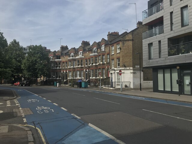
Stand on Southwark Bridge Road today and you are standing on a piece of private enterprise's unfinished business. The bridge that gives the road its name was never going to be free — it was built by private investors, meant to turn a profit. But a bridge to nowhere is worthless. So in 1819, the year the bridge opened, someone had to improvise: connect whatever streets already ran south of the river, stitch them together, and call it a road. That improvisation is Southwark Bridge Road. For sixty years it remained disconnected — a tentacle reaching north from the southern suburbs but never quite grabbing hold of the main arterial system. Then in the 1880s the city cut Southwark Street through, and the cul-de-sac became a proper crossing.
Name Origin
Servant to a Private Bridge
Southwark Bridge Road takes its name directly from Southwark Bridge, the Thames crossing that terminates at its northern end. The bridge opened in 1819, financed as a private venture — a toll bridge intended to pay back its investors through passage fees. But a bridge needed an approach road, and this was the problem: private bridges could not legally use the public highway system, which meant Southwark Bridge's operators had to ensure their own access from the southern shore. The solution was to thread together a series of existing streets into a makeshift through-route. The new road, opened the same year as the bridge, took the name of its terminus. It was, in effect, infrastructure built to serve infrastructure.
History
A Sixty-Year Dead End
Southwark Bridge Road was created in 1819 by connecting a sequence of existing streets to forge a new path from the south to Southwark Bridge. The route runs from Newington Causeway, near Elephant and Castle, northward in a meandering course to the bridge itself, crossing the Thames into the City of London. Yet for its first sixty years, the road led north into isolation. It had no proper junction with the main London road network — a traveller arriving via Southwark Bridge Road could reach the bridge, but reaching the city's primary routes remained problematic.
That constraint was broken in the 1880s, when Southwark Street was cut through. This new arterial route connected Southwark Bridge Road to the main northern roads, finally integrating what had been a bridge-serving appendage into London's circulatory system. The timing was critical for the area's development — South London was expanding rapidly, and Southwark Bridge Road was no longer an isolated approach but a functioning link in a larger web of movement.
Culture
Bridges, Theatres, and Institutions
Southwark Bridge Road's character is defined by its terminus and its neighbours. At its northern end, across Southwark Street near the river, stands Anchor Terrace — a Georgian building that occupies the site of Shakespeare's original Globe Theatre, a tangible connection to early modern London's theatrical heart. Nearby, the Rose Theatre Exhibition offers direct access to the archaeology and history of another Renaissance playhouse. The Financial Times headquarters also sits in this northern cluster, marking the street's proximity to major institutional and commercial centres.
At the southern end, London South Bank University occupies a significant presence, anchoring the road as an educational destination. From 2015 onward, the street underwent major redevelopment. The London Fire Brigade Museum and the London Fire Brigade Training Centre, both long established on Southwark Bridge Road, closed to make way for new development — a marker of the area's ongoing transformation from industrial and institutional uses toward mixed-use regeneration.
Today
A Link in the Network
Southwark Bridge Road today is designated the A300 — a main road carrying consistent traffic across South London, connecting southern suburbs to the river and the City beyond. What began as a private bridge's necessary appendage has become a key artery in London's transport system. The street remains mixed in character: sections of commercial property, institutional anchors like the university, and ongoing redevelopment, all threaded between the historic sites and the modern road's steady flow. The narrative of its creation — infrastructure built to serve infrastructure — has given way to a street fully integrated into the life of its area, long past the point where the bridge that named it stands out as remarkable.
On the Map
Southwark Bridge Road Then & Now
Frequently Asked Questions
Why is it called Southwark Bridge Road?
Southwark Bridge Road takes its name from Southwark Bridge, the Thames crossing at its northern terminus. The road was created in 1819 to provide access to the newly opened bridge. Because Southwark Bridge was privately financed, it could not use the public highway system, so a dedicated approach road had to be built by connecting existing streets.
Why was the road created in 1819?
Southwark Bridge opened in 1819 as a private venture — financed by investors to generate toll revenue. A private bridge needed its own access route, since it could not legally tap the public road network. Southwark Bridge Road was created that year by threading together a series of existing streets to forge a path from the southern suburbs to the bridge.
Was Southwark Bridge Road always well-connected to the rest of London?
No. For its first sixty years, from 1819 to the 1880s, Southwark Bridge Road remained isolated — it led to the bridge but had no proper connection to London's main arterial road network. This changed in the 1880s with the creation of Southwark Street, which finally linked Southwark Bridge Road to the broader transport system and allowed the area to develop more fully.