Time Walk
A Road Built on Layers


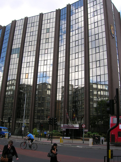
Stand at the Elephant and Castle and look northward up Newington Causeway, and you are standing on a road that has been in use for nearly two thousand years. Beneath the modern asphalt lies a Roman metalled surface — the trace of Stane Street, the ancient road that connected Roman London to the south coast. When medieval Southwark spread outward into marshy fields, that same line was the only feasible path. When a new south London emerged in the eighteenth century, it was still the only path worth naming. The name that stuck — Newington Causeway — was practical: a raised way across a bog. Today it is South London's quietest medical quarter, where twentieth-century physicians, publishers, and architects left their mark on a road that had already outlasted empires.
Name Origin
A Causeway Through the Marsh
Newington Causeway takes its name from the practical solution to a geographical problem. The street does not appear to have been named until the middle of the 18th century, per the Survey of London, though the road itself had existed for centuries as a raised way across the marshy terrain of St. George's Fields. A causeway — a built-up roadway that could bear traffic across waterlogged ground — was the only engineering solution available before modern drainage. The name is descriptive rather than commemorative: it tells you what the road is and what it had to do to exist.
History
Before the Road: The Roman Foundation
The history of Newington Causeway begins not with its naming but with its route. The street follows the line of Stane Street, the Roman road that connected Roman London to Chichester on the south coast. In 1952, during roadworks about 300 yards north of the Elephant and Castle, archaeologists discovered a section of metalled Roman road approximately 4 feet below the existing surface. The curve of Newington Causeway westward was probably determined by Roman-era topography, as the line appears to have been the only feasible route through St. George's Fields that could be made into a firm road without modern engineering techniques, per the Survey of London.
Medieval and Eighteenth-Century Development
The marshy terrain persisted for centuries. When John Stow described the area in the sixteenth century, he recorded that in 1555 the ground up to Newington Church had been flooded; the causeway itself would have been a dry passage through this inundated landscape. By the middle of the eighteenth century, the street had acquired its modern name and had begun to develop, with the eastern side built up with houses by 1746. In 1820, Southwark Bridge Road was diverted by Act of Parliament to join Newington Causeway at the Elephant and Castle, with a prescribed minimum width of 45 feet, reflecting expectations of significant traffic.
Institutional Development and Medical Practice
The nineteenth and early twentieth centuries transformed Newington Causeway into a centre of medical and institutional life. A Sessions House was built with an approach from Newington Causeway; its front was described by Henry Mayhew in 1862. The old Sessions House was replaced in 1921 with a new building, completed on 11 January of that year.
In 1912, an outpatients' department of the South London Hospital for Women and Children was opened on Newington Causeway, supported by Harriet Shaw Weaver, the publisher of The Freewoman. Cecil Belfield Clarke, a physician and originator of Clark's rule for paediatric dosing, lived and practised on Newington Causeway from the 1920s through the Second World War. Clarke was also a founder of the League of Coloured Peoples, an early anti-racist organisation in Britain.
Twentieth-Century Architecture
The street's architectural character changed dramatically in the 1960s with Metro Central Heights, originally known as Alexander Fleming House, a series of multi-storey blocks designed by Hungarian-British architect Ernő Goldfinger at the southern end of Newington Causeway. Originally designed as office accommodation, it was later converted into residential flats. The Institute of Optometry at 56–62 Newington Causeway, formerly the London Refraction Hospital, carries the street's medical identity forward to the present day.
Culture
Medicine and Modernism on an Ancient Route
Newington Causeway's cultural significance lies in the accumulation of specific individuals and institutions rather than a single landmark. The street became a centre for medical innovation in the early twentieth century. Harriet Shaw Weaver, a significant feminist publisher, raised funds for the South London Hospital for Women and Children's outpatients' department here in 1912. Cecil Belfield Clarke's presence from the 1920s onward marked it as a place where medical practice intersected with anti-racism activism; he was both a leading paediatrician and a founder of the League of Coloured Peoples, one of Britain's earliest organisations dedicated to fighting racial discrimination.
Architecturally, Ernő Goldfinger's Metro Central Heights represents one of South London's most assertive pieces of 1960s modernism. The multi-storey blocks, converted from offices to residential use, stand as a visible mark of the street's mid-twentieth-century transformation. The Institute of Optometry at 56–62 Newington Causeway carries forward the street's medical identity into the present day, per Wikipedia.
Newington Causeway forms part of the A3 road, one of Britain's major routes from London southward. It began as a Roman road, persisted as a medieval causeway through a marsh, and has carried commerce and traffic for nearly two millennia.
Today
A Working Road With Layers of History
Newington Causeway today remains a major route connecting the Elephant and Castle to Borough High Street, carrying A3 traffic southward. Each layer of stone and brick carries a trace of what came before: the Roman metalled surface four feet below the street; the eighteenth-century causeway that gave the road its name; the Victorian Sessions House; the twentieth-century medical practitioners who made it a centre of innovation; the 1960s modernist blocks that remain monuments to that architectural moment. The street's character remains partly medical and partly commercial, as it has been for over a century. Newington Causeway continues to channel traffic across the same ancient line that Roman engineers laid down nearly two thousand years ago.
On the Map
Newington Causeway Then & Now
Frequently Asked Questions
Why is it called Newington Causeway?
The street is named for the causeway — a raised roadway built across marshy ground — that allowed passage through St. George's Fields. The name does not appear to have been applied to the street until the middle of the 18th century, though the road itself had existed for centuries as a practical route across waterlogged terrain. The name is descriptive rather than commemorative: it tells you what the road is and what it had to do to function.
What is the connection to Roman Stane Street?
Newington Causeway follows the route of the Roman road Stane Street, which connected Roman London to Chichester on the south coast. A section of the original Roman metalled surface was discovered in 1952 during roadworks, approximately 4 feet below the modern street surface. The curve of Newington Causeway appears to follow the only feasible route through the area that could be made into a firm road without modern engineering techniques.
Why did medical institutions cluster on Newington Causeway?
The sources record that the South London Hospital for Women and Children opened an outpatients' department on the street in 1912, and that physicians including Cecil Belfield Clarke practised there in the twentieth century, but they do not explain why the street became a medical centre. What is clear is that the street's institutional character — the Sessions House, the hospital, the medical practitioners — made it a significant site for professional and welfare activity in twentieth-century South London.