Time Walk
The Lane That Still Bends to Church


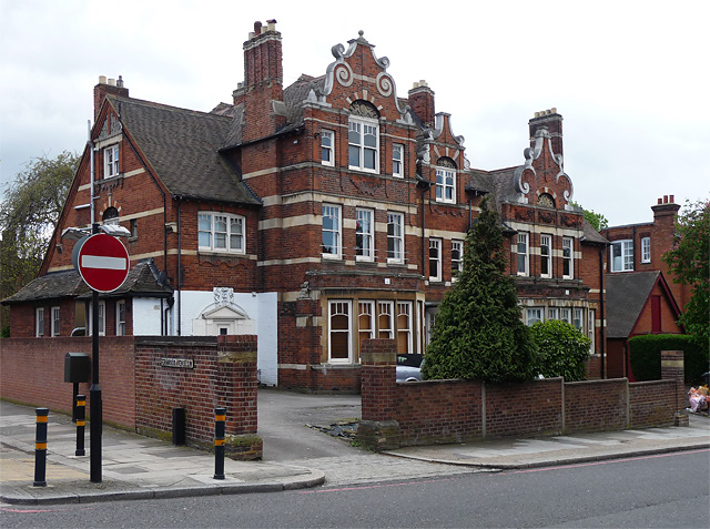
This was once the end of a trackway people simply called Long Lane, heading for Tooting Bec. Walking it today, you cross from the open grass of Tooting Bec Common, pass a modern cluster of houses at Pinkerton Place, and watch the road bend south toward a church spire.
Beneath the pavement, archaeologists treat this whole stretch of Streatham as worth watching closely. The street's gentle turn still traces the route into the old village heart of Streatham. That turn is the clue to where the name comes from.
Name Origin
A Norman Abbey's Name on a Streatham Lane
The name reaches back to Normandy. The manor of Tooting Bec began as two separate Domesday estates, one in Tooting and one in Streatham, held before the Conquest by men named Estarcher and Erding under Edward the Confessor.
Before 1086 both estates were granted by Richard de Tonbridge, lord of Clare, to the abbey of Bec Hellouin in Normandy. That abbey's name stuck to the manor, and the manor's name later attached itself to this street and to the common beside it. The road itself began life as the eastern end of a trackway known as Streatham Lane, or Long Lane, leading toward Tooting Bec. The sources used here do not explain exactly when the lane took on its present name.
History
From Manor Lane to Village Edge
For centuries this was simply the way to Tooting Bec. The street bends south toward St Leonard's Church, at what was once the historic centre of the village of Streatham.
By the late nineteenth century, building had reached the street in earnest. The Church of the English Martyrs rose at its junction with Streatham High Road in 1893. A decade later, in 1908, St Leonard's church hall opened facing the street, built as a memorial to the long-serving Rector of Streatham, John Richard Nicholl.
Lambeth's archaeologists later placed the whole area within Archaeological Priority Area No. 6, "Streatham," a zone centred on Tooting Bec Gardens.
Culture
A Spire Over the Village Edge
Two churches frame this street. St Leonard's church hall faces the street a little further along, opened in 1908 as a memorial to a long-serving rector.
People
Sixty Years in the Parish
John Richard Nicholl held the living of Streatham for sixty-one years, from 1843 to 1904, and was made an Honorary Canon of Rochester during his time there. When he died, the parish built St Leonard's church hall facing Tooting Bec Gardens as his memorial, opening it on 1 June 1908.
Recent Times
What Replaced the Gaps
War left gaps in the street. Nos. 61–65 Tooting Bec Gardens were demolished after the Second World War, and in the 1980s the site was rebuilt as Pinkerton Place, a development of detached housing blocks.
A 1983 watching brief during building work at St Mary's Convent, which stands on or near Tooting Bec Gardens, turned up a late medieval cellar beneath the site.
Today
Two Streets in One
Tooting Bec Gardens still reads as two places joined. Its western section sits set back from Tooting Bec Road, facing Tooting Bec Common across a strip of grass, while the street runs on between Streatham High Road and Prentis Road before bending toward St Leonard's. The church spire at its eastern end, the 1980s housing at its western, and the old bend toward the village church in between still mark out the route that once simply led to Tooting Bec.
On the Map
Tooting Bec Gardens Then & Now
Frequently Asked Questions
Why is it called Tooting Bec Gardens?
It takes its name from the medieval manor of Tooting Bec, two Domesday estates granted before 1086 to the abbey of Bec Hellouin in Normandy. The street itself began as the eastern end of a trackway once called Streatham Lane or Long Lane.
What is Tooting Bec Gardens known for?
For the Church of the English Martyrs (1893) at its eastern junction, with its 136-foot-9-inch spire, and for St Leonard's church hall, opened in 1908 as a memorial to a Victorian rector of Streatham.
Is there anything medieval left on Tooting Bec Gardens?
Below ground, yes. A 1983 watching brief at St Mary's Convent, which stands on or near the street, uncovered a late medieval cellar, and the area is now treated as an archaeological priority zone.