Time Walk
A Lane With Two Lords


For centuries this lane marked where one lord's land ended and another's began. Walk it today and you'll pass a busy run of small independent shops, the red-brick library halfway along, and an old grocer's shopfront. It feels, at first glance, like an ordinary high street.
Underneath the shopfronts, the lane still does its oldest job: marking a manor boundary far older than the name written down for it. That older division is where the story of "Lordship" really begins.
Name Origin
The Line Between Two Manors
The name is literal. Lordship Lane divides the manors of Dulwich and Camberwell-Friern, and during the Middle Ages became their formal boundary. A "lordship" was a manor's territory under its lord; this lane ran along the edge of two such lordships, and took its name from that function rather than from any person.
It was known as Lordship Lane by at least the 17th century, and was probably called that for several centuries before anyone wrote it down. It also formed part of an old route south out of London, continuing the line of Dog Kennel Lane, now Dog Kennel Hill, to the north. One strand of the record even holds that the lane itself was cut during the reign of Richard I, between 1189 and 1199, though this is probable rather than certain.
So the lane is older than the name recorded for it, and the name is older than almost anything built along it. It is a boundary first, a street second.
History
From Spring to Suburb
Water first drew people here. In the Stuart era a fresh spring was found at the edge of Dulwich Wood, and Francis Cox built a tavern beside it to attract travellers. Soon after 1732 Cox cut an oak-lined avenue, Cox's Walk, linking his tavern and wells to the rival spa at Sydenham Wells.
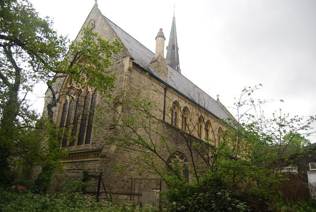
Building along the lane itself began in earnest in the 19th century. East Dulwich Chapel went up opposite Goose Green in 1826, at the start of the lane. A railway station called Lordship Lane opened on 1 September 1865 on the new line to Crystal Palace, taking its name from the lane it stood on. A fire station opened on the lane in 1893, serving until war damage closed it in 1947.
The library at No. 368 opened on 24 November 1897, designed by Charles Barry Jr as architect to Alleyn's College of God's Gift. Its foundation stone had been laid by Henry Irving the previous year, and the Lord Chancellor, Lord Halsbury, performed the opening. A little further along, No. 549 — the Concrete House — was built in 1873 by Charles Drake, an early example of a house built from concrete.
Culture
A Painter's View, A Comedian's Stage
Lordship Lane has kept a stage as well as a street. The Magdala Tavern at No. 21 hosted East Dulwich Comedy, a comedy club that ran from 1988 until it closed in 2015. St Thomas More Catholic Church was designed by Joseph Goldie in 1929. Its stained glass is by Patrick Pye, and the Lady Chapel added in 1970 holds a Madonna and Child statue by Freda Skinner.
Commerce has left its own trace: the David Greig shop at No. 65 still has its original late-Victorian interior, a rare survival among the grocery chains that once lined streets like this one.
People
A Novelist, A Publican, A Frontman
Enid Mary Blyton, the children's author, was born at 354 Lordship Lane on 11 August 1897.
Enid Blyton's birthplace at No. 354 and Dulwich Library's opening at No. 368 both date to 1897 — the same year, a few doors apart.
Other figures appear more briefly in the record. Ezekiel James Bailey, publican of the Lord Palmerston, built houses on the Tulse Hill estate in 1865. More recently, the Libertines' Carl Barât is recorded as living on the lane.
Recent Times
What the Railway Left Behind
The railway that once ran beside the lane is long gone. Lordship Lane station closed on 20 September 1954, along with the line it stood on, and was demolished in 1957. The fire station closed in 1947.
What survives has been protected rather than replaced: the library, the David Greig shopfront, and the Concrete House are now all protected. Nearby streets filled in with terraces and semi-detached houses between the 1890s and 1920s, part of the same wave of growth that spread south from Dulwich Village.
Today
Still the Edge of Something
Dulwich Library still anchors the junction with Woodwarde Road. A red-brick bank from between the wars stands opposite, and a finger post still marks the crossroads. The Dulwich Estate's boundary still runs along part of the lane, a quieter echo of the manorial line it once marked.
Lordship Lane today is East Dulwich's high street — shops, a library, a church, a vanished railway remembered only in a name. It has swapped lords for shopkeepers, but it is still, as it always was, a line between one place and the next.
On the Map
Lordship Lane Then & Now
Frequently Asked Questions
Why is it called Lordship Lane?
The name refers to manorial "lordship" rights. The lane divides the manors of Dulwich and Camberwell-Friern and became their formal boundary during the Middle Ages. It was already known as Lordship Lane by at least the 17th century, probably earlier.
What is Lordship Lane known for?
It's East Dulwich's main shopping street, home to the Grade II-listed Dulwich Library (1897), a surviving 1890s David Greig grocer's shopfront, and the house at No. 354 where Enid Blyton was born in 1897.
Is Lordship Lane railway station still open?
No. It opened in 1865 on the Crystal Palace and South London Junction line, closed on 20 September 1954 with the rest of that line, and was demolished in 1957.