Southwark London England About Methodology
Southwark · SE1

Keppel Row

An alleyway transformed from industrial decay into a sustainable urban corridor, named after an 18th-century naval hero.

Named After
Admiral Augustus Keppel
First Recorded
c. 1799
Borough
Southwark
Character
Pedestrian Alley
Last Updated
Time Walk

From Alley to Green Corridor

Keppel Row is a formerly dingy alley in Southwark that’s been recently refurbished. The alleyway links Southwark Bridge Road and Great Guildford Street, serving as a traffic-free pedestrian route through The Borough. For decades it remained a neglected passage, with hop warehouses to the north and an asbestos factory nearby—a forgotten space between busier streets.

Historical image not found
Today
Kepple Row — near Keppel Row
Geograph · CC BY-SA 2.0

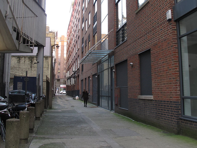
The transformation of Keppel Row is complete, with attractive and functional rain gardens, improved accessibility, a striking example of public art and many small details that keep the changes true to the character of the historic alley. A mysterious golden figure, created by artist Marian Grolmus, carefully watches over the street from a parapet. Today the alley has become a model for sustainable urban design—but its name carries a much older story.

✦   ✦   ✦
Name Origin

A Naval Hero’s Legacy

The field surrounding Keppel Row was laid out with streets by 1799 and known as Keppel Street, reputedly after Admiral Augustus Keppel, 1st Viscount Keppel. Keppel Row is named after Augustus Keppel, 1st Viscount Keppel, an 18th-century naval figure. The renaming as Keppel Row seems to have taken place sometime between 1896 and 1940. The word’s etymology adds another layer: the golden figure references the etymology of the word Keppel, deriving from ‘cappa’ meaning cape.

How the name evolved
c. 1799 Keppel Street
1896–1940 Keppel Row
present Keppel Row
✦   ✦   ✦
History

Rural Fields to Industrial Corridor

In the 1740s, the area was still fields, although by now surrounded by increasing amounts of development. Development accelerated as London expanded southward. The field surrounding Keppel Row was laid out with streets by 1799, creating the framework that would define this quarter of The Borough for the next two centuries.

Key Dates
1740s
Rural Surroundings
The area remains open fields, though development closes in.
1799
Streets Laid Out
The field is subdivided and Keppel Street is established, named after Admiral Keppel.
Late 1800s
Industrial Decline
Hop warehouses and an asbestos factory move into the neighbourhood, making it a rough, unwelcoming space.
1896–1940
Name Change
Keppel Street is renamed Keppel Row, the new designation reflecting its character as a narrow passage.
2019
Transformation Begins
The alley undergoes radical regeneration with rain gardens, permeable paving, and public art.
Did You Know?

At the eastern end, bollards are marked with ‘Clink’, from when the area was part of the Liberty of the Clink prison.

By the late nineteenth century, the old houses had gone along the north side, and wouldn’t have been a nice place to live for those left, with hop warehouses to the north, but more worryingly, an asbestos factory next to the hops. The alley became a forgotten corridor between busier roads, neglected and overlooked for over a century. It took a modern push toward sustainable urban design to restore it.

✦   ✦   ✦
Culture

Art and Ecology in the Alley

Public Art
The Golden Watcher

Artist Marian Grolmus created a mysterious hooded golden figure that overlooks the alley from a roofline, its cape intentionally echoing the etymology of the street’s name. The sculpture invites passersby to look upward and discover the hidden story of the place they walk through.

The 2019 renovation transformed Keppel Row into an exemplar of environmental design. Research conducted by the Environmental Research Team at King's College revealed that people were exposed to 25 per cent less air pollution by walking on Keppel Row or America Street, compared to walking on Southwark Street. The raingardens help to manage surface flooding, with timber sleeper edging that references the nearby railway viaduct. The alley now demonstrates how a neglected space can be reimagined as a cleaner, more pleasant alternative to congested main roads.

✦   ✦   ✦
Today

A Model for Change

Where it was once rather run-down, today it is a clean space lined with planting and a special surface to walk on that is made of a permeable gravel that enables rain water to pass through. Keppel Row now functions as one of The Borough’s most striking examples of responsive urban greening. The permeable paving filters stormwater, rain gardens manage surface runoff, and the art installation gives the alley an identity that rewards a second glance.

For residents and workers in the area, Keppel Row offers a quiet alternative to Southwark Street’s traffic and noise. The transformation shows how even the smallest, most overlooked spaces can be reimagined with vision and care—and how the names we give our streets, rooted in naval heroes and old fields, connect us to the deeper layers of London’s past.

5 min walk
Southwark Cathedral Churchyard
Quiet green refuge in the heart of The Borough, with mature trees and benches.
8 min walk
London Bridge Park
Riverside green space with views of Tower Bridge and Thames-side plantings.
✦   ✦   ✦
On the Map

Keppel Row Then & Now

National Library of Scotland — Ordnance Survey 6-inch, c. 1888. Hosted by MapTiler. Modern: © OpenStreetMap contributors.

✦   ✦   ✦

Frequently Asked Questions

Why is it called Keppel Row?
The street is named after Admiral Augustus Keppel, 1st Viscount Keppel, an 18th-century naval figure. When the field was laid out with streets c. 1799, it was called Keppel Street. The name was changed to Keppel Row sometime between 1896 and 1940. The word itself is believed to derive from the Old English ‘cappa’, meaning cape—a reference the artist Marian Grolmus playfully echoed in her golden sculpture overlooking the alley.
What happened to Keppel Row in the 19th century?
By the late 1800s, Keppel Row had become a run-down industrial corridor. Hop warehouses moved in to the north, and an asbestos factory was built nearby—a dangerous combination that made it an unpleasant place to live. The alley remained neglected and overlooked for over a century, until the recent regeneration project transformed it.
What is Keppel Row known for today?
Keppel Row is now recognised as a model for sustainable urban design. The 2019 transformation included rain gardens, permeable paving, and public art by Marian Grolmus. Research showed that air quality in the alley is 25 per cent better than on nearby Southwark Street, making it a safer and more pleasant pedestrian route. The alley demonstrates how even small, overlooked spaces can be reimagined to benefit both people and the environment.