Explore London England Scotland Wales About API
Southwark · SE5

Coldharbour Lane

A Saxon shelter name became a vital artery connecting village to city. From medieval wayfarers to modern Brixton, this lane has named itself exactly what it is—a refuge that offers nothing but passage.

Name Meaning
Saxon Shelter
First Recorded
c. 1740s
Borough
Southwark
Character
Mixed Use
Last Updated
Time Walk

From Camberwell to Brixton Market

Coldharbour Lane is a street of transitions. Starting in Camberwell as a quiet, tree-lined residential avenue of Victorian terraces, it slowly transforms as you walk southwestwards towards Brixton, where Victorian redbrick gives way to independent cafés, Caribbean restaurants, shops, and the bustling Brixton Market. SE1 Direct documents this as one of south London's most visible acts of urban stratification—the lane itself marks the postcode boundary at Loughborough Junction, where SE5 becomes SW9.

2013
North end of Coldharbour Lane, Camberwell
Wikimedia Commons · CC BY-SA 2.0
2013
Architectural contrasts on Coldharbour Lane, Camberwell
Wikimedia Commons · CC BY-SA 2.0
Historical image not found
Today
Caldecot Road, Camberwell — near Coldharbour Lane
Geograph · CC BY-SA 2.0

Today, the street is a working thoroughfare: buses thunder down its length, residents walk to the station, traders stock their shutters. But the name inscribed on every signpost is older than the houses, older than the railway, and older than London itself.

✦   ✦   ✦
Name Origin

The Bare Refuge

The name comes from Anglo-Saxon: ‘cald’ (cold) and ‘herbergh’ (a refuge, lodging or shelter). But ‘cold’ here does not mean temperature—it means bare, uninhabited, uncomforted. A cold harbour was an uninhabited shelter for travellers, often along a well-known route. Unlike an inn, there were no staff, food or drink to be had. There would be a roof, door and possibly a simple hearth, although it was the traveller’s responsibility to gather fuel.

J. C. Hahn documented this etymology in Notes and Queries in 1865, tracing the origins to the German kalte Herberge, and this etymological analysis was accepted by the Merriam-Webster dictionary. Hahn concluded that “our Cold Harbour was a name given to any cold abode, cold retreat, brought over to England by our Saxon ancestors—Cold Harbour = Cold Station, Cold House, Cold Lodge”. The name appears across England, on medieval roads where drovers would rest stock overnight and merchants shelter briefly. On Roque's Map of London’s environs (1741–45), the lane was still called Camberwell Lane, a record that pinpoints when the transition to its modern name occurred.

How the name evolved
medieval Camberwell Lane
c. 1740s Coldharbour Lane
present Coldharbour Lane
Cold Harbour = Cold Station, Cold House, Cold Lodge.
J. C. Hahn, Notes & Queries (1865)
✦   ✦   ✦
History

From Manor Boundary to Railway Corridor

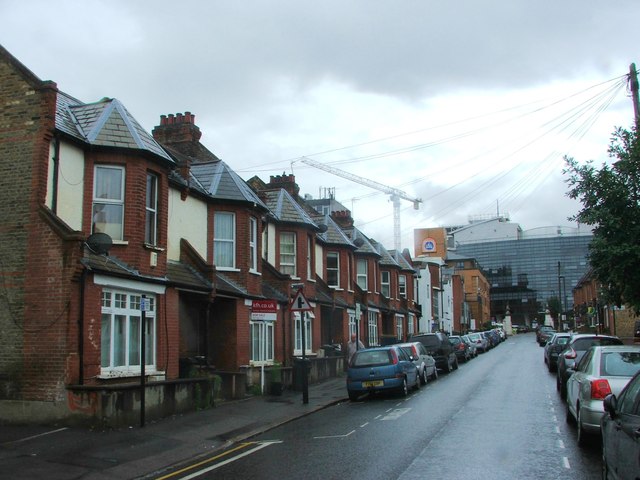
According to local historian Olive M. Walker, the Cold Harbour was located within the boundaries of the Manor of Coldharbour which abutted the Lane then known as Camberwell Lane. The manor comprised a mansion house, two barns, a stable, garden, orchard and meadow and pasture lands. By the early 19th century, the land was used chiefly as pasture and market garden ground before the great suburban expansion of south London began in earnest. British History Online's Survey of London documents how Loughborough Park was formed in the years 1844–57, and the detached portion of the Manor on the north-west side of Coldharbour Lane was built up in the early 1830s. The street thus became the spine of development, marking property boundaries and connecting newly laid streets.

Key Dates
c. 1270
Manor Estate
Manor of Coldharbour established as a substantial estate with buildings and farmland.
1741–45
Roque's Map
Lane recorded as Camberwell Lane on John Roque's map. Name change to Coldharbour Lane occurs within the next few decades.
1824–50
Suburban Building
Properties on the Lane developed as Victorian villas and terraces. Building leases granted to Lord Holland and onwards.
1865
Etymology Established
J. C. Hahn publishes articles in Notes & Queries confirming Saxon origin of Cold Harbour name.
1865
Railway Opens
Loughborough Junction station opens on the Lane, transforming it into a transport hub.
1800
Prince of Wales Pub
Historic pub established on the Lane, still operating today.
1981
Brixton Riots
Civil unrest erupts in nearby roads; windows broken on Coldharbour Lane itself.
1997
Gun Violence
Multiple shootings recorded on the street, marking the height of gang-related activity.
Did You Know?

The Camberwell beauty butterfly, one of the UK’s rarest migrants, was first formally recorded in scientific literature after two specimens were discovered on Coldharbour Lane in 1748. The butterflies likely arrived as stowaways on timber ships from Scandinavia bound for Surrey Docks.

The lane closed by Brixton Market became visibly derelict by the mid-1960s. Drug houses flourished, dealing mainly in cannabis. The 1981 Brixton riots exposed deeper fractures—windows were broken on the street itself, and with the support of community leaders and shop owners, plans were put in place to set up a mini-police station on Coldharbour Lane in the former premises of a drug dealer, with Police Safer Neighbourhoods Teams working from number 411. The 1990s and early 2000s saw further incidents: in June 1997, Anthony Baker was shot in the head during a raid at the Control Tower takeaway, just a few hundred yards from where Chief Inspector Alan O’Gorman was addressing a meeting about spiralling gun crime. In 2003, a newspaper described the lane as “the most dangerous street in the most dangerous borough in London”.

Recovery has been slow but real. Since the 2010s, gentrification and investment have gradually transformed the southern stretch. Independent businesses have opened; the rail corridor has been better maintained; community policing continues. Police bases closed in 2019, signalling a shift away from emergency-response policing to a normalised street. Today, the lane thrums with life again—not as it was in the Victorian era, but as a genuinely mixed neighbourhood.

✦   ✦   ✦
Street Origin Products

Your listing has a better story than it’s telling

Coldharbour Lane has 250 years of documented history, from a Saxon shelter through Victorian expansion to modern Brixton regeneration. Here’s how to put it to work—and why it converts.

Professional Edition
Street Pack
“Why this address matters.”

Buyers pay more for addresses with a story. The Street Pack gives estate agents and developers brochure-ready copy, prestige framing and a name origin panel—everything needed to make this address feel significant before a viewing is booked.

  • Brochure copy — 100 & 200 word versions
  • Prestige framing version
  • Name origin panel
  • Timeline strip
  • Buyer persona framing
For estate agents, developers & property portals
From £19
Get the Street Pack
Street Social Kit
“Why this place feels interesting.”

Airbnb guests choose atmosphere as much as amenities. The Social Kit gives you five ready-to-post tiles, story templates, captions, hooks and a Reel script—all built from this street’s actual history. Done for you, in minutes.

  • 5 ready-to-post social tiles
  • 3 Story templates
  • 5 captions & 3 hooks
  • 1 Reel script
  • Hashtag clusters
For Airbnb hosts, boutique landlords & small agents
From £9
Get the Social Kit
✦   ✦   ✦
Culture

Street as Stage

The lane has become a cultural landmark beyond its geography. Brixton-based band Alabama 3 named their debut album Exile on Coldharbour Lane after the road, though the mention of the street is omitted from the “Chosen One Mix” used as the theme song for The Sopranos. The Quireboys released a single titled “Coldharbour Lane” in 2001, with the hook “So long / I’ve done my time / Coldharbour Lane / Goodbye”. Markus Schulz named his own recording label “Coldharbour Recordings” in honour of the time when he lived in a flat in Coldharbour Lane.

Literary & Architectural Heritage
Pubs & Watering Holes

The Prince of Wales in Brixton has been on the same site since 1800. Historic establishments including the Prince Albert, the Dogstar, Club 414, and the Plough offer snapshots of the lane’s social life. Several older pubs—the Green Man, the Angel, the Enterprise—closed between 2000 and 2007, marking the shift away from traditional pub culture towards newer forms of hospitality.

✦   ✦   ✦
People

Residents & Records

Former British Prime Minister John Major lived in a flat at 144 Coldharbour Lane when a child from 1955 to 1959, a biographical detail that anchors the street in recent political history. The lane has also appeared in contemporary music, fashion, and digital culture through the artists who have chosen to live and work here. Beyond named individuals, the street’s real legacy rests with its merchants, traders, residents, and the community leaders who rebuilt it after the riots—the names not recorded in formal histories but embedded in the street itself.

✦   ✦   ✦
Recent Times

Regeneration & Resilience

The 2010s brought marked investment. Brixton Academy reopened as a music venue, independent retailers returned, and the street’s profile rose in cultural media. Coldharbour Lane began appearing in film and television as the visual shorthand for “authentic South London”—vibrant, mixed, unpolished. Community policing models evolved. TfL improved Loughborough Junction station, signalling commitment to public transport links. The lane became a place that people chose to visit, not just pass through.

Yet gentrification has brought tensions. Long-standing residents worry about displacement. Rents rise. Independent businesses struggle against chains. The “bare refuge” of its name—the place that offers shelter but demands self-sufficiency—takes on new meaning. In the 21st century, those passing through the lane are no longer drovers or medieval travellers. They are commuters, students, workers, tourists. The shelter it offers is not a medieval barn but social mobility, cultural connection, and economic possibility—still cold to those without means to access it.

✦   ✦   ✦
Today

A Living Artery

The lane runs just over a mile, never wide, always busy. The northern stretch holds Victorian terraces in neat rows, their sash windows and red brick now familiar to thousands of commuters catching the 45 bus to central London. As you walk south from Camberwell Green towards Loughborough Junction, the character shifts subtly: independent cafés appear, shops narrow, the street gains density. By the time you reach Brixton Market’s chaos of colour, stall-noise, and Caribbean grocers, the formal London of Camberwell feels distant. Yet the name persists, unchanged since the 18th century, a historical thread running through both worlds.

Architecturally, it is a study in South London’s layers: Victorian workers’ housing, Edwardian corner shops, 1970s brutalist flats, modern apartment conversions, all coexisting without synthesis. Loughborough Junction railway viaduct shadows much of the street, carrying trains that have run since 1865. The street feels lived in, contested, and real in a way that many sanitised London lanes are not.

6 min walk
Myatt's Fields Park
Lambeth's largest green space with mature trees, play areas, and community facilities.
10 min walk
Archbishop Park
Victorian civic park with terraced gardens and views across south London.
12 min walk
Brockwell Park
Large Herne Hill estate with lake, boating, and historic Brockwell Hall.
8 min walk
Loughborough Park
Victorian crescent enclosing mature trees and community gardens.
✦   ✦   ✦
On the Map

Coldharbour Lane Then & Now

National Library of Scotland — Ordnance Survey 6-inch, c. 1888. Hosted by MapTiler. Modern: © OpenStreetMap contributors.

✦   ✦   ✦

Frequently Asked Questions

Why is it called Coldharbour Lane?
The name derives from Anglo-Saxon English: ‘ceald’ (cold) and ‘herbergh’ (shelter). It describes a bare, uninhabited refuge for medieval travellers—a structure offering protection from the elements but no food, warmth, or staff. The modern street inherited this name from the medieval Manor of Coldharbour that once abutted it. Originally the lane was called Camberwell Lane; the name Coldharbour appears on maps from the 1740s onwards.
What was a cold harbour used for?
Cold harbours were roadside shelters for wayfarers, drovers moving stock to market, and merchants travelling between towns. Travellers had to bring their own bedding, food, and fuel. The shelter itself might be nothing more than a barn, a hollow in terrain, or a stand of trees offering protection from wind and weather. They were typically located along established routes and sometimes evolved into trading posts or waystation settlements.
What is Coldharbour Lane known for today?
Today, Coldharbour Lane is known as a vibrant, mixed-use corridor stretching from residential Camberwell to the bustling markets and independent retailers of Brixton. It marks the postcode boundary at Loughborough Junction railway station. The street is historically significant for the 1981 Brixton riots, which began in nearby roads but left their mark on the lane itself. More recently, it has become a focal point for South London regeneration, attracting independent businesses, cultural venues, and young residents drawn to its authentic character and transport links.