Lambeth London England About Methodology
Lambeth · SE11

Brixton Road

The road that carries the name of a Saxon lord’s boundary stone — first laid down by the Romans, still running to Brighton today.

Name Meaning
Stone of Brixi
First Recorded
1086 (Domesday)
Borough
Lambeth
Character
Regency & retail
Last Updated
Time Walk

The Road the Romans Started, Brixton Finished

Brixton Road runs through the Oval in south London, and for much of its length it is still framed by the Regency terraces that went up in the 1820s and 1830s. Some are immaculate; others carry the worn look of streets that have absorbed a century and a half of change without losing their bones. The River Effra, once visible alongside the road, now runs beneath the pavements as a storm drain — its vanished presence the only real secret the street keeps from passers-by.

2011
341-361 Brixton Road, Lambeth
Wikimedia Commons · CC BY-SA 2.0
2015
Brixton Road
Brixton Road
Wikimedia Commons · CC BY-SA 2.0
Historical image not found
Today
339 Brixton Road, Brixton
Geograph · CC BY-SA 2.0

At its northern end in the Oval neighbourhood stands Christ Church, its Neo-Byzantine façade the most arresting thing on the block. At the southern end, Windrush Square anchors a different kind of landmark — Lambeth Town Hall, the Ritzy Cinema, and the statue of Henry Tate. The name of the road is so familiar it rarely prompts a question. It should.

✦   ✦   ✦
Name Origin

Brixi’s Stone and the Saxon Hundred

The name most likely reaches back to a single stone. Brixton is thought to derive from Brixistane — “the stone of Brixi” — a Saxon lord who is believed to have erected a boundary marker to indicate the meeting place of the ancient Brixton hundred court of Surrey. The Domesday Book of 1086 records the place as Brixiestan. As documented by the Brixton Society’s research into the name’s origins, Brixi’s real English name was Beorhtsige — meaning “bright victory” — which the Normans found difficult to pronounce and progressively abbreviated. The stone itself may have stood on a principal road, described in the charter as strate in Old English and via in Latin, consistent with a Roman alignment.

The road was formerly known as the Washway, a name reflecting the boggy ground through which the River Effra once overflowed across the Oval lowland. As recorded by British History Online in the Survey of London, Brixton Road and Brixton Hill may have formed part of a Roman road running from Brighton through the Weald to join Stane Street near Kennington Park — making this one of the oldest routes in south London.

How the name evolved
1086 Brixiestan
c. 1530 Bristowe Cawsey
pre-1800 The Washway
19th c. Brixton Road
present Brixton Road
✦   ✦   ✦
History

Turnpike, Terrace, and the Archbishop’s Land

For most of its history, Brixton Road ran through open farmland and market gardens. The area remained largely rural until the early nineteenth century, its development held back by the boggy ground of the Oval depression and the absence of a convenient Thames crossing. That changed decisively in 1816 when Vauxhall Bridge opened.

Key Dates
c. 70 AD
Roman Route
Evidence suggests Brixton Road follows the alignment of a Roman road from Brighton to Kennington Park.
1086
Domesday Record
The Domesday Book records Brixiestan, the earliest known written form of the name Brixton.
1806
Enclosure Act
The Lambeth Manor Enclosure Act stipulates no buildings may be erected within 150 feet of the London–Croydon Turnpike Road (now Brixton Road), ensuring generous garden frontages.
1816
Vauxhall Bridge Opens
The new bridge catalyses suburban development; Regency terraces begin lining Brixton Road from the Oval southward.
1824
St Matthew’s Consecrated
St Matthew’s Church is consecrated on former common land at the south end of Brixton Road, indicating a now-substantial local population.
1877
Bon Marché Opens
The first purpose-built department store in Britain opens on Brixton Road — a sign of the road’s new commercial status.
1887
Sherlock Holmes
Arthur Conan Doyle sets the first crime scene of the entire Holmes canon in an abandoned house off the Brixton Road in A Study in Scarlet.
1902
Christ Church
Christ Church, Brixton Road — designed by Beresford Pite in an eclectic Byzantine style — is consecrated at the northern end of the road.
Did You Know?

In 1887, Arthur Conan Doyle chose an abandoned house off Brixton Road as the very first crime scene in the entire Sherlock Holmes series. The murder in A Study in Scarlet — Holmes’s debut — is discovered here before Holmes and Watson have even properly met.

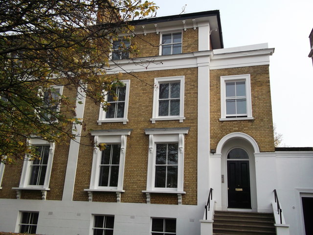
The Archbishop of Canterbury’s manor of Lambeth Wick owned much of the land flanking the road. As the Survey of London records, the development of Lambeth Wick did not begin until 1820, delayed partly by uncertainty over the route of the new Vauxhall Bridge approach roads. Between 1820 and 1824, the whole of the manor was let under fifteen building leases to Henry Richard Vassall, third Baron Holland. The resulting development was, in the words of the Survey, piecemeal — producing “unrelated groups of villas and terrace houses” that gave the Brixton Road frontage an “untidy and haphazard appearance” despite the charm of individual buildings.

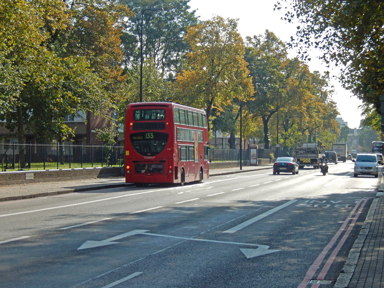
The railway arrived in 1862 and sparked a second building boom. By 1881 Brixton’s population had reached 62,837. The road became a shopping destination of regional importance, anchored by Britain’s first purpose-built department store, Bon Marché, which opened in 1877 at the corner of Brixton Road and Ferndale Road.

✦   ✦   ✦
Culture

Holmes, Henry Tate, and the Market Arcades

The most famous literary moment on Brixton Road arrives before Sherlock Holmes has even become famous. In the 1887 novel A Study in Scarlet, a constable discovers a body in a locked, abandoned house off the road — the first of the dozens of crime scenes that would follow across the Holmes stories. Conan Doyle placed it here deliberately: to a Victorian reader, Brixton Road was knowable, respectable, and just south enough to feel slightly beyond the safest parts of London.

Saved by Listing
Brixton Market Arcades

The covered market arcades adjacent to the two railway viaducts near Brixton Road were granted listed building status in 2009, following controversial proposals by Lambeth Council to demolish them and replace them with a large American-style shopping mall. The listing by Historic England recognised their distinctive character as one of London’s best-preserved Victorian market environments, securing their survival for future generations.

At the southern end of Brixton Road, the former “Brixton Oval” holds Lambeth Town Hall, the Ritzy Cinema, and the Tate Library — endowed by Henry Tate, whose statue stands outside it. Tate, the sugar magnate and founder of the Tate gallery collection, funded the library in 1893. The square was renamed Windrush Square in 2010, in honour of the HMT Empire Windrush, which in 1948 brought 492 passengers from Jamaica to London, many of whom settled in Brixton.

📖 Literature
Tinker Tailor Soldier Spy
John le Carré · 1974
MI6 scalphunters headquarters located on Brixton Road.
📺 TV
The Apprentice
BBC · 2014
Recorded vox pops on Brixton Road in June 2014.
🎵 Music
The Guns of Brixton
The Clash · 1979
Written by Paul Simonon, who grew up in Brixton.
✦   ✦   ✦
People

Sugar Barons, Saxon Lords, and a Prime Minister

Henry Tate is the most legible name attached to this end of Brixton Road. The sugar refiner and art patron funded the Brixton library — now the Tate Library — which still bears his name and his statue. A man of immense Victorian philanthropy, Tate later donated his collection of British art to the nation, forming the nucleus of what became Tate Britain. His connection to Brixton Road is memorialised in stone outside the library he gave the neighbourhood.

John Major, who became Prime Minister in 1990, grew up in Brixton in the streets around Brixton Road. His childhood in the area — used prominently in his 1992 election campaign — made Brixton Road a political symbol of social mobility. Less celebrated but equally formative, Brixi the Saxon lord, whose boundary stone gave the road its name, remains the road’s original “notable person”: known only through a single Domesday entry, yet commemorated in every sign along the A23.

✦   ✦   ✦
Recent Times

Operation Swamp, the Riots, and Regeneration

In April 1981, tensions that had been building for years between the Brixton community and the Metropolitan Police erupted into three days of rioting. The immediate trigger was “Operation Swamp 81”, a policing operation that deployed plainclothes officers to stop and search on Brixton Road and neighbouring streets — nearly 1,000 people in five days. The riots that followed were among the most serious civil disturbances in twentieth-century London and led directly to the Scarman Report into policing and race relations.

The Regency terraces that line Brixton Road had become semi-derelict by the 1970s. Many were refurbished by the Greater London Council, mostly as social housing — a form of conservation that preserved the streetscape while reordering who lived there. In 2009, the Brixton Market arcades off the road gained listed building protection, halting a redevelopment scheme. More recently, debates over gentrification have centred on the road’s railway arches, where long-established businesses faced displacement following Network Rail refurbishments from 2016.

“The road…part of which was sometimes called the Washway, as far as Kennington.”
Survey of London, Vol. 26 — British History Online
✦   ✦   ✦
Today

The A23 That Still Runs to Brighton

Brixton Road is the A23 — the old London-to-Brighton road — and carries that weight visibly. The Oval neighbourhood end near SE11 remains largely residential, its Regency terraces intact enough to suggest the 1820s streetscape. The community charity SE1 Direct and local history groups have documented the gradual stabilisation of these buildings following the GLC refurbishments. Further south, the road becomes Brixton’s high street: markets, music, the Ritzy, the railway arches, Windrush Square.

The road’s green relief is close at hand. Kennington Park lies within a short walk of the northern end; Brockwell Park, one of south London’s finest open spaces, is reachable from the Brixton end. The buried River Effra still runs below the pavement, and the road still points, as it has since at least Roman times, in the direction of the sea.

8 min walk
Kennington Park
Victorian park on former common land; gardens, café and historic lodges immediately north of the Oval.
10 min walk
Vauxhall Park
Small but well-tended community park with a miniature village and a popular community garden.
20 min walk
Brockwell Park
One of south London’s grandest parks, with a lido, walled garden, and panoramic views over the city.
Beneath the pavement
River Effra
The lost tributary of the Thames, once visible alongside the road, now flows as a Victorian brick sewer below its surface.
✦   ✦   ✦
On the Map

Brixton Road Then & Now

National Library of Scotland — Ordnance Survey 6-inch, c. 1888. Hosted by MapTiler. Modern: © OpenStreetMap contributors.

✦   ✦   ✦

Frequently Asked Questions

Why is it called Brixton Road?
Brixton Road takes its name from Brixton, a district whose name most likely derives from Brixistane — “the stone of Brixi” — a Saxon lord believed to have erected a boundary marker indicating the meeting place of the ancient Brixton hundred court of Surrey. The Domesday Book of 1086 records the place as Brixiestan. The road was earlier known as the Washway, and may follow a Roman alignment running from Brighton to Kennington Park.
Was Brixton Road really a Roman road?
It is believed to have been, at least in part. The Survey of London, as held by British History Online, records that research indicates a Roman road ran from Brighton through the Weald and Croydon, then followed the line of the modern Brixton Hill and Brixton Road to form a junction near Kennington Park. No Roman surface has been confirmed in Lambeth by excavation, but the alignment is considered strongly consistent with a Roman route. Excavation work by MOLA in the wider Lambeth area has found Roman-period activity, though no confirmed road surface on this alignment to date.
What is Brixton Road known for?
Brixton Road is the main artery of one of London’s most culturally significant districts. It is the A23, the historic London-to-Brighton road, lined along much of its length by surviving Regency terraces. At its southern end, Windrush Square — renamed in 2010 — commemorates the Caribbean migrants who shaped modern Brixton. The nearby Brixton Market arcades gained listed building protection in 2009. And in 1887, Arthur Conan Doyle set the very first crime scene of the entire Sherlock Holmes series in an abandoned house off this road.