Southwark London England About Methodology
Southwark · SE5

Camberwell Grove

An avenue of Georgian townhouses on a hilltop that once afforded views of the City of London, named after the trees that lined the approach to a Tudor manor.

Name Meaning
Grove of Trees
First Recorded
c. 1775
Borough
Southwark
Character
Georgian Terrace
Last Updated
Time Walk

A Hilltop of Elegant Stone

Camberwell Grove, Grove Lane and Addington Square have some of London's most elegant and well-preserved Georgian houses. The street rises from the north end toward a gentle summit, where the street once led from a Tudor manor house south to the top of a hill, which afforded a view of the City of London, approximately three miles to the north. Today, the grove is part of Camberwell Grove Conservation area.

2011
Houses on Camberwell Grove
Wikimedia Commons · CC BY-SA 2.0
2012
38-60 Camberwell Grove
Wikimedia Commons · CC BY-SA 2.0
2019
The Hermitage (2)
The Hermitage (2)
Wikimedia Commons · CC BY-SA 3.0
Today
Junction of Camberwell Grove and Grove  Park
Junction of Camberwell Grove and Grove Park
Geograph · CC BY-SA 2.0

The street's character is defined by its cohesive architecture—cream-coloured stucco facades, tall sash windows, and small private gardens separating each terrace from the pavement. Plane trees still line the route in places, descendants of the grove that gave the street its name centuries ago. The street remains primarily residential, a pocket of 18th-century order in an ever-changing borough.

✦   ✦   ✦
Name Origin

Trees on an Estate Avenue

It follows the line of a grove of trees, hence the name. Camberwell Grove is named from the avenue which led up to the house. That house was the Tudor manor of Camberwell Buckingham, which stood on the estate of the Bowyer family. The avenue of mature trees was a common feature of 17th-century country estates, providing both ornament and shelter. When the manor was demolished in the mid-1770s and the land subdivided into building plots, the avenue's name endured as the new street took shape.

The broader place name, Camberwell, derives from Old English and likely refers to the healing mineral springs that once drew people to the area. The most ancient part of the village is that which surrounds what till lately was the Green; but the more pleasant and favourite spot is the Grove, which stands high, and commands pleasant views over Dulwich.

How the name evolved
c. 1650–1750 The Bowyer Estate Grove
1775 Grove Estate
present Camberwell Grove
✦   ✦   ✦
History

Rural Speculation to Urban Respectability

In the mid-1770s, when Camberwell was still a rural village, the dilapidated manor house was demolished and the surrounding land subdivided and sold. The first four houses, still standing today (numbered 79–85), were built by speculators at the northern end as a terrace shortly afterwards. These Grade II-listed properties set the tone for the street’s future character—solid, respectable, and fashioned for the professional classes attracted by Camberwell’s healthy air and proximity to London.

Key Dates
c. 1775–80
Manor Demolished
The Tudor manor house demolished; land subdivided and sold to developers.
1776–85
First Terraces Built
Speculators build the northern terrace (nos. 79–85) and southern properties (nos. 33–45).
1800s
Lettsom Estate Broken Up
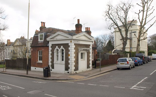
Dr. John Coakley Lettsom's villa demolished; The Hermitage (no. 220) survives. Estate razed when subdivided.
1819
Grove Chapel Built
David R Roper designs and builds Grove Chapel, a Grade II-listed structure.
1860s
Railway Below
South London and East London lines built by London, Brighton and South Coast Railway; pass below street in tunnel and cutting.
1889
Booth Survey
Victorian social researcher Charles Booth assesses residents; northern end 'fairly comfortable', southern end 'wealthy'.
1940s
War Damage
Houses damaged by bombing in WWII; demolished. Site rebuilt as flats (nos. 100–138).
Did You Know?

In 2012, the street was the subject of an episode of the BBC series The Secret History of Our Streets, based on the work of Victorian social researcher Charles Booth.

John Coakley Lettsom (1744–1815) was a noted 18th century Quaker physician and herbalist, friend of Benjamin Franklin, Dr. Johnson, Boswell and other intelligentsia of the day. He commissioned a villa on the southern rise of Camberwell Grove, where a side-street, Lettsom Street, Lettsom Gardens, a community garden, and a nearby housing estate are named in his honour. One of his cottages, The Hermitage (number 220), survives, at the junction with Grove Hill Road. A number of other buildings on the street, including Grove Chapel (built 1819, by David R Roper) and the Georgian crescent terrace of eight houses forming Grove Crescent, are also listed.

The railways transformed the street's landscape. The South London and East London railway lines, built by the London, Brighton and South Coast Railway in the 1860s and now operated by Southeastern and London Overground, pass below the street (in a tunnel to the west and cutting to the east), just east of Denmark Hill station. In the 20th century, some of the houses on the grove were damaged by bombing in World War II, and subsequently demolished. The site is now occupied by the flats numbered 100–138. In the 1960s, a proposal to build an elevated motorway across the grove, above the railway, in the style of the Westway, was opposed and eventually overturned by local residents.

✦   ✦   ✦
✦   ✦   ✦
Culture

Artists and Television

The street’s appeal to creative professionals grew in the latter 20th century. The artists David Hepher and his wife Janet bought a house on the grove in 1961, and set up studios there. Hepher, a significant figure in contemporary British art, was drawn to the street’s architectural integrity and the quiet it offered for artistic work. Television producer Jeremy Bennett also settled on the Grove, reflecting Camberwell’s broader appeal to London’s professional and creative classes.

Listed Architecture
A Street of Grade II Buildings

The terrace numbered 79–85, Grove Chapel (1819), Grove Crescent, and The Hermitage cottage are all Grade II listed, protecting their architectural character and historical significance for future generations.

The street was immortalised by the BBC’s documentary series The Secret History of Our Streets, which used Charles Booth’s meticulously detailed 1889 survey of residents’ social class to explore how neighbourhoods change across a century. The episode revealed how Camberwell Grove, once a street of ‘well-to-do’ and ‘wealthy’ households, experienced gradual change when revisited a decade later.

✦   ✦   ✦
People

Physicians, Artists, and Makers

Dr. John Coakley Lettsom lived and was celebrated by John Scott and other writers of the early 19th century. Lettsom was instrumental in establishing Camberwell as a centre of intellectual and scientific life, hosting gatherings that drew physicians, botanists, and writers. His legacy is embedded in the street itself: the avenues and gardens he sponsored remain, and the named streets preserve his memory.

Later residents brought different talents. The artists David Hepher and his wife Janet bought a house on the grove in 1961, and set up studios there. Hepher’s work in sculpture and installation art found a home in the spacious Georgian interiors of the street, where 20th-century creativity met 18th-century architecture. Jeremy Bennett, a television producer, represented the post-war generation’s discovery of South London as a place to live and work.

✦   ✦   ✦
Recent Times

Preservation and Change

The late 20th century saw Camberwell Grove become a focus of conservation efforts. The street’s designation as part of the Camberwell Grove Conservation Area in the 1970s reflected growing recognition of its architectural value and the need to protect it from inappropriate development. Planning controls became stricter, and many Victorian and Georgian properties were carefully restored rather than demolished.

Today, the street remains a sought-after address, with property values reflecting both the scarcity of well-preserved Georgian housing in South London and the neighbourhood’s cultural renaissance. The street avoided the worst of 1960s–70s redevelopment that blighted other parts of Camberwell, thanks partly to the vigorous local opposition to the proposed elevated motorway. This success in resisting inappropriate development created a template for conservation-led regeneration that has influenced urban planning ever since.

✦   ✦   ✦
Today

A Living Conservation Area

Camberwell Grove today is a mixed-tenure street, with substantial private houses, residential conversions, and period rental properties. The pavements remain lined with mature plane and lime trees, and the stucco terraces are largely intact, their cream and white facades now regularly repainted to Period Colour standards. The street is quiet during the day—traffic is limited by traffic-calming measures and the presence of the Conservation Area designation.

The nearest station is Denmark Hill station, just east of the street, served by the South London and East London railway lines now operated by Southeastern and London Overground. The area has benefited from improved transport links and the opening of new cultural venues and restaurants along nearby Bellenden Road and Camberwell Church Street. Parks within walking distance include Ruskin Park, Peckham Rye, and Lettsom Gardens, a community green space maintained by and for local residents.

Lettsom Gardens
Adjacent
Community-managed green space with woodland, allotments, and historical connection to Dr. Lettsom’s estate.
Ruskin Park
10 min walk
Landscaped Victorian park with mature trees, pond, and views toward the South London hills.
Peckham Rye Park
12 min walk
Large open space with meadow, woodland, and historic ponds; visited by Turner and other 18th-century artists.
Brockwell Park
15 min walk
Grade II listed park with Regency villa, walled gardens, and panoramic London views.
✦   ✦   ✦
On the Map

Camberwell Grove Then & Now

National Library of Scotland — Ordnance Survey 6-inch, c. 1888. Hosted by MapTiler. Modern: © OpenStreetMap contributors.

✦   ✦   ✦

Frequently Asked Questions

Why is it called Camberwell Grove?
The street is named after the avenue of trees that once lined the approach to the Tudor manor house on the estate. When the manor was demolished in the 1770s and the land subdivided for building, the street inherited the name of that historic grove.
When were the first houses built on Camberwell Grove?
The first four houses (numbered 79–85) were built in the late 1770s as a Grade II-listed terrace at the northern end of the street, shortly after the manor house was demolished. Further development continued throughout the 19th century, with Grove Chapel added in 1819 and Grove Crescent built as a Georgian terrace of eight houses.
What is Camberwell Grove known for?
Camberwell Grove is celebrated as one of London’s finest surviving Georgian residential streets, with elegant cream-coloured stucco terraces and a conservation area designation. It is also historically significant as the home of Dr. John Coakley Lettsom (1744–1815), a renowned Quaker physician and botanist, and later as a residence for artists and television producers. The BBC’s documentary series The Secret History of Our Streets featured the street in 2012.