Time Walk
A Lane to the River, Still Running True


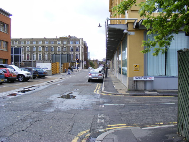
A path to the Thames once ran here, long before it carried a duke's name. John Norden described a lane running to the river along this line as early as 1615. Today the street holds a corner pub, terraced houses and shopfronts marking the junction with Roupell Street.
Beneath the terraces lies a windmill, a market garden and a corn mill that once stood here, on ground once called Prince's Meadows, where the road was cut and widened two centuries ago and given a new name.
Name Origin
Green Lane Becomes the Duchy's Road
Cornwall Road was known as Green Lane before 1815. Around that time it was widened into a continuation of the old lane, running north and south across Prince's Meadows.
The new name came from the Duchy of Cornwall. The land formed part of the manor of Kennington, which belonged to the Duchy, and the road was named for it in 1815. The pack does not explain the origin of "Cornwall" beyond this manorial link.
History
From Botanic Garden to Printing Works
A botanic garden once stood beside this road. William Curtis opened the London Botanic Garden in January 1779, lying between Green Lane and Broadwall. By 1815 the lane had been widened and renamed Cornwall Road, and extended to reach a timber yard at Neptune Place on the riverfront.
A windmill followed. In 1817 John Ashby, a miller of Brixton Hill, took a 99-year lease of two acres on the south side of the new road, together with a brick corn mill built there the previous year. By 1843 Ashby let the eastern half of the plot to the builder John Muggeridge, who put up seven houses fronting Cornwall Road.
A church rose nearby in the 1850s. In 1854 the Commissioners for Building New Churches bought a plot between Prince's Street, now Coin Street, and Cornwall Road from Richard Palmer Roupell. St. Andrew's, designed by Samuel Sanders Teulon, was consecrated there in June 1856.
The twentieth century brought printing and government offices. W. H. Smith & Son built a large printing works on Stamford Street, between Waterloo and Cornwall Roads, in 1914-16. Nearby, Cornwall House, built for H.M. Stationery Office, served for a time as King George's Hospital before becoming government offices from 1920. Boots Chemists added a large building at the east corner of Cornwall Road in 1936.
A corn mill once stood on Cornwall Road: John Ashby's 1817 lease describes "a Brick corn Mill and other erections" on his two acres beside the road.
Culture
A Faience Corner Pub
The stretch of Cornwall Road inside the Roupell Street Conservation Area mixes shop buildings at the Roupell Street corner with terraced houses and the White Hart itself. Further along, No. 24 is a modest building valued less for itself than for how it sets off the buildings beside it.
People
A Gangster's Birthplace
The gangster 'Mad' Frankie Fraser was born on Cornwall Road in Waterloo. The pack gives no further detail of his time here, only the fact of his birth on the street.
Recent Times
Marking the Conservation Area's Edge
Cornwall Road now marks a boundary rather than a centre. Since 2007 it has formed the west edge of the Roupell Street Conservation Area.
Today
Terraces Beside a Painted Pub Front
A dated townhouse still stands among the later infill. No. 25 Cornwall Road carries the date 1820 on its front. Close by, the White Hart's faience corner remains the most distinctive thing to see on the street, a reminder that this was a lane long before it was named for the Duchy of Cornwall.
On the Map
Cornwall Road Then & Now
Frequently Asked Questions
Why is it called Cornwall Road?
The road, formerly Green Lane, was widened and renamed around 1815 because its land fell within the manor of Kennington, which belonged to the Duchy of Cornwall.
What is Cornwall Road known for?
It is known for its corn mill and windmill of 1816-17, St. Andrew's church nearby, the 1930s Boots building on Stamford Street, and as the birthplace of gangster 'Mad' Frankie Fraser.
Was there really a windmill on Cornwall Road?
Yes. John Ashby, a miller, leased two acres on the street in 1817 that included a brick corn mill built at the south-west corner of his land the previous year.
"a Brick corn Mill and other erections"John Ashby's 1817 lease, quoted in the Survey of London, Vol 26