Explore London England Scotland Wales About API
Southwark · SE1

West Lane

A boundary lane on the western edge of Bermondsey’s old parish, pressed against one of the greatest leather-making districts the world has ever known.

Name Meaning
Western boundary lane
First Recorded
18th century
Borough
Southwark
Character
Residential, post-industrial
Last Updated
Time Walk

Leather, Lime and the Western Edge

West Lane sits in the heart of old Bermondsey, a corner of SE1 whose pavements once reeked of the tanning pits that made this district the leather capital of Britain. The street runs through a neighbourhood that has reinvented itself multiple times — from marshy parish boundary to industrial slum, from post-war council estate to the gentrifying quarter that now sits in the shadow of the Shard. The nearest green is Bermondsey Spa Gardens, a five-minute walk to the west. The nearest tube, just minutes away, is Bermondsey on the Jubilee line.

What remains constant is the lane’s relationship to the wider grid of Bermondsey streets, many of whose names — Long Lane, Bermondsey Street, Grange Road — are as old as the medieval abbey that once anchored this entire district. The name “West Lane” is deceptively plain, but its simplicity hides a specific, deliberate function. That function, and what gave this lane its label, goes back to the organisation of the old Bermondsey parish itself.

2011
West Lane shops
West Lane shops
Wikimedia Commons · CC BY-SA 2.0
2011
Garden on West Lane
Garden on West Lane
Wikimedia Commons · CC BY-SA 2.0
Historical image not found
Today
West Lane from Bermonsdey Wall East
Geograph · CC BY-SA 2.0
✦   ✦   ✦
Name Origin

The Lane at the Parish’s Western Edge

The name “West Lane” is a straightforward positional descriptor: it identifies the lane that ran along the western limit of the old Bermondsey settlement. British History Online’s Victoria County History records that the parish of St Mary Magdalene, Bermondsey, “comprehended the Snows Fields on the west of Bermondsey Street, the Court Yard and Grange Yard, and the road from Bermondsey Street to West Lane” — using the lane itself as a named western boundary marker. In a district where parallel lanes were typically named by compass direction or relative position, “West Lane” served the same administrative purpose as nearby “East Lane” on the opposite side of the settlement.

The word “lane” in early modern English denoted a narrow way between properties or fields, distinct from the broader “road” or “street.” In Bermondsey’s case, these lanes often followed the edges of the abbey’s landholdings or the drainage ditches that crisscrossed the marshy ground. “West” here is not west of London, nor west of Southwark — it is west relative to the heart of Bermondsey’s own settlement grid, which radiated from the area around the abbey and Bermondsey Street. The name carries no personal or commemorative meaning: it is purely geographical, and probably in common use well before it appeared in written records.

How the name evolved
pre-18th c. West Lane (oral use)
18th century West Lane (mapped)
present West Lane
✦   ✦   ✦
History

Abbey Margin to Industrial Crucible

The ground around West Lane belonged, from the medieval period, to the parish of St Mary Magdalene, Bermondsey — a parish that owed its entire character to the Cluniac abbey founded here in 1082. As British History Online’s Victoria County History records, the parish “became important from the existence of the abbey, which probably reclaimed, embanked and cultivated it,” and “preserved its rural character until the 17th century.” For six centuries, this was open ground: drained marshland, abbey gardens, and rough lanes linking the monastery to the wider Southwark road network.

Key Dates
1082
Abbey founded
Bermondsey Cluniac priory established, beginning the reclamation and cultivation of the surrounding marshland that would eventually become the West Lane area.
c. 1700
Tanning expands
The leather trade consolidates in Bermondsey after the City of London bans tanning within its walls. The streets around West Lane become central to an industrial cluster producing hides and skins.
1703
Royal Charter
Queen Anne grants the Bermondsey Tanners a Royal Charter, formalising the trade that had defined this neighbourhood for two centuries.
1833
Leather Market opens
The Leather and Skin Market opens on nearby Weston Street, consolidating the trade that surrounded West Lane and drawing workers from across the district.
c. 1881
Peak population
Bermondsey’s population reaches 86,000, up from 17,000 in 1801. The streets around West Lane are densely packed with workers’ housing and industrial yards.
1940–41
Blitz damage
Bermondsey is bombed heavily throughout the Second World War, destroying or damaging many of its tanneries and Victorian terraces, including streets close to West Lane.
1999
Jubilee line arrives
Bermondsey station opens on the Jubilee line extension, transforming the accessibility of West Lane and triggering a long wave of regeneration in the surrounding streets.
Did You Know?

By 1792, Bermondsey produced one-third of all leather made in England. The industry that surrounded West Lane wasn’t just local — it supplied saddles, boots, belts and bookbindings to an empire.

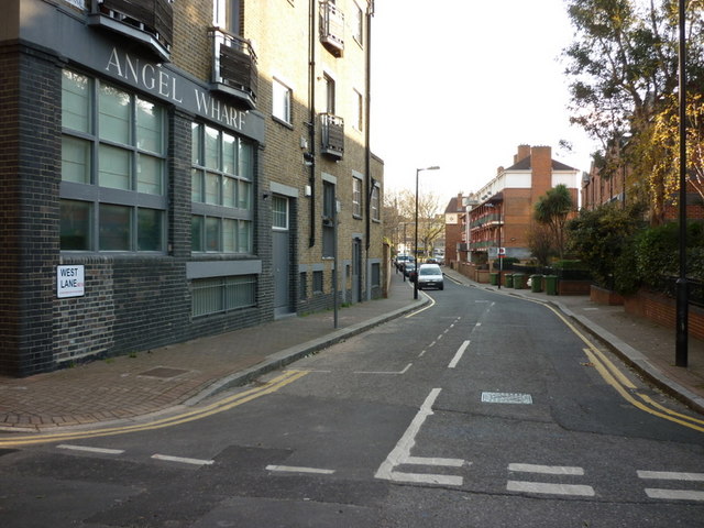
The transformation from rural parish margin to industrial district was swift and brutal. Bermondsey’s population rose from 17,000 in 1801 to 86,000 by 1881, driven by the leather and allied trades. Tanning had been banned within the City of London’s walls because of its foul smells — the process required urine, lime, and dog dung to soften hides — and Bermondsey, south of the river with plentiful water and space, absorbed the entire industry. The streets around West Lane filled with tanneries, fellmongers’ yards, and the back-to-back housing of workers who could not afford to live anywhere else. Bermondsey’s tanners earned the area the nickname “the land of leather,” and the trade was granted a Royal Charter by Queen Anne in 1703. By mid-century the Leather Market on nearby Weston Street was a commercial institution of national importance.

The Second World War left lasting marks. Bermondsey was bombed heavily throughout the conflict, destroying tanneries and workers’ housing alike. What the Blitz did not destroy, the post-war clearances often did: much of the housing stock immediately around West Lane was replaced by council estates in the decades that followed. The early 20th-century Bermondsey Borough Council — noted for its progressive character — had already begun extensive slum clearance and social reform programmes, and the London County Council continued the process after the war. The archaeological work of MOLA (Museum of London Archaeology) in the wider Bermondsey area has documented the physical traces of this lost industrial landscape, including tanning pits and associated infrastructure from the medieval and post-medieval periods.

✦   ✦   ✦
Street Origin Products

Your listing has a better story than it’s telling

West Lane sits in one of London’s most storied industrial districts — the land of leather, Bermondsey Abbey’s old parish, and a neighbourhood transformed by the Jubilee line. Here’s how to put that history to work.

Professional Edition
Street Pack
“Why this address matters.”

Buyers pay more for addresses with a story. The Street Pack gives estate agents and developers brochure-ready copy, prestige framing and a name origin panel — everything needed to make this address feel significant before a viewing is booked.

  • Brochure copy — 100 & 200 word versions
  • Prestige framing version
  • Name origin panel
  • Timeline strip
  • Buyer persona framing
For estate agents, developers & property portals
From £19
Get the Street Pack
Street Social Kit
“Why this place feels interesting.”

Airbnb guests choose atmosphere as much as amenities. The Social Kit gives you five ready-to-post tiles, story templates, captions, hooks and a Reel script — all built from this street’s actual history. Done for you, in minutes.

  • 5 ready-to-post social tiles
  • 3 Story templates
  • 5 captions & 3 hooks
  • 1 Reel script
  • Hashtag clusters
For Airbnb hosts, boutique landlords & small agents
From £9
Get the Social Kit
✦   ✦   ✦
Culture

The Smell That Built an Empire

The cultural weight of West Lane’s neighbourhood is inseparable from the leather trade. By 1792, this corner of Bermondsey was producing one-third of all leather made in England — a dominance that shaped the diet of the streets, the rhythm of working life, and the social character of every lane in the district. Workers emerged at midday covered in tan-stained trousers and raw-hide aprons, the smell of hides and processing chemicals clinging to the entire neighbourhood. Charles Dickens, who knew this part of London well, wrote that Bermondsey’s air “reeks with evil smells.” That was not a complaint — it was a description of prosperity.

Archaeological Layer
Tanning Pits Beneath the Streets

MOLA excavations across Bermondsey have revealed tanning pits, beam pits and associated medieval and post-medieval industrial features buried beneath the modern street level. The subsurface archaeology of the West Lane area preserves evidence of the industry that dominated this landscape for five centuries — invisible from the pavement above, but recorded in detail by Museum of London Archaeology’s ongoing research into the borough’s industrial past.

The Bermondsey Tanners were granted a Royal Charter by Queen Anne on 15 July 1703 — a mark of the trade’s national importance. The great Victorian expression of that industry survives nearby: the Leather Market on Weston Street (1833) and the London Leather, Hide & Wool Exchange (1878), both now listed buildings monitored by Historic England. The Exchange’s ornamental roundels — carved scenes of cattle, hides and tanners at work — are a permanent footnote to the culture of the streets around West Lane, a culture that lasted until the last Bermondsey tannery closed in 1997.

✦   ✦   ✦
People

Workers, Reformers and the Borough’s Own

No single named individual has been identified as living or working on West Lane itself, but the street existed within a neighbourhood whose human story was shaped by some of Victorian London’s most significant figures. The Bevington family — whose Neckinger Mills operation began in 1806 — were the dominant tanners of Bermondsey for most of the nineteenth century. Samuel Bourne Bevington, the borough’s first Mayor after incorporation in 1900, was a leather producer and one of the area’s largest employers; his statue stands in nearby Tooley Street to this day.

The working-class residents who occupied the lanes around West Lane in the Victorian period were the real protagonists of this neighbourhood’s story. The community covered by these streets saw progressive local government under the early twentieth-century Bermondsey Borough Council, which undertook some of the most ambitious slum clearance and public health programmes of any London borough — work that SE1 Direct, Southwark’s own community news platform, has documented as part of the area’s long social history. George Peabody’s philanthropic trust, which built improved model dwellings for working-class Londoners from 1862, also had an estate at Bermondsey, providing a counterpoint to the district’s worst housing conditions.

✦   ✦   ✦
Recent Times

From Tannery to Jubilee Line

The last tannery in Bermondsey closed in 1997, ending a continuous industrial tradition that had begun in the medieval period. The Jubilee line extension arrived two years later, in 1999, with Bermondsey station — designed by Ian Ritchie Architects — opening yards from West Lane and bringing the street within direct reach of Canary Wharf and the West End for the first time. That single infrastructure event transformed the economics of every address in the immediate area.

The warehouse conversions and new residential developments that followed were part of a borough-wide regeneration wave documented by SE1 Direct. Victorian brick buildings that had housed tanning operations or workers’ storage were converted into flats and studios. The streets immediately around West Lane shifted from an almost entirely working-class industrial character to a mixed residential and creative quarter. The leather-trade buildings that survived — the Leather Market, the Hyde Exchange — are now protected by Historic England and serve as workspace and event venues, wearing their industrial heritage as a badge of distinction.

✦   ✦   ✦
Today

A Quiet Lane in a Changed Quarter

West Lane today is a residential street in a neighbourhood that has completed its post-industrial reinvention. The tanneries are gone; the pits are sealed; the smell that once defined these streets is a memory preserved only in street names and the roundels of the Leather Exchange on Weston Street. What remains is a compact urban lane, close to the Jubilee line, with the characterful independent cafes, galleries and food markets of the wider Bermondsey quarter within a short walk. Borough Market and London Bridge are roughly twelve minutes on foot.

The green spaces within reach are a particular asset. Bermondsey Spa Gardens — a formal park with lawns and a Victorian character — is five minutes west. Southwark Park, London’s first municipal park when it opened in 1868, is a fifteen-minute walk south-east. Together they offer the kind of open-air respite that the Victorian tannery workers of this district could never have imagined from their back-to-back terraces on these same streets.

5 min walk
Bermondsey Spa Gardens
A formal Victorian park with lawns and mature trees, west of the lane. Popular with local residents and a green anchor for the surrounding streets.
10 min walk
St George’s Gardens
Former churchyard of St George the Martyr, now a quiet pedestrianised green space with trees. Associated with Dickens’s Little Dorrit.
15 min walk
Southwark Park
London’s first municipal park, opened 1868. 25 acres of open grassland, a lake and a gallery, south-east of West Lane.
12 min walk
Potters Fields Park
Riverside park on the Thames bank near Tower Bridge, offering open views and Thames Path access. A complete contrast to the lane’s enclosed urban character.
✦   ✦   ✦
The land of leather — by 1792 a third of all leather in the country came from Bermondsey.
Local historian Patricia Dark, quoted in Southwark News
✦   ✦   ✦
On the Map

West Lane Then & Now

National Library of Scotland — Ordnance Survey 6-inch, c. 1888. Hosted by MapTiler. Modern: © OpenStreetMap contributors.

✦   ✦   ✦
1082 Abbey Parish
c. 1700 Tannery Quarter
1800s Industrial Peak
1940s Blitz & Clearance
1999 Jubilee Line
Today Regenerated Quarter
✦   ✦   ✦

Frequently Asked Questions

Why is it called West Lane?
West Lane takes its name from its position as the westernmost lane in the old Bermondsey settlement. The Victoria County History records the road from Bermondsey Street to West Lane as a named boundary of the parish of St Mary Magdalene, Bermondsey, using the lane as a western limit marker. The name is a straightforward directional descriptor — the lane lying to the west of the Bermondsey settlement grid — rather than a personal or commemorative name. The same logic produced “East Lane” on the opposite side of the district.
What industry defined the streets around West Lane?
The leather and tanning trade. The City of London banned tanning within its walls because of the noxious smells involved — the process required urine, lime, and dog dung to soften hides. Bermondsey, south of the river, absorbed the entire industry. By 1792 the district produced one-third of all leather made in England. The streets around West Lane were flanked by tanneries, fellmongers’ yards and leather warehouses for over two centuries, until the last Bermondsey tannery closed in 1997.
What is West Lane known for?
West Lane is a residential street in Bermondsey, SE1, close to Bermondsey Jubilee line station. It sits within one of London’s most historically significant industrial districts — the leather-trade heartland that dominated this part of south London from the medieval period into the late twentieth century. The surrounding streets retain Victorian warehouse buildings, the listed Leather Market and Leather Exchange on Weston Street, and a growing creative and residential quarter that has emerged since the Jubilee line opened in 1999.