Southwark London England About Methodology
The Borough · SE1

Kentish Buildings

A narrow Georgian court that carries the name of a 17th-century property owner and the memory of an inn where pilgrims once departed for Canterbury.

Named After
Thomas Kentish
Character
Georgian Court
Borough
Southwark
Last Updated
Time Walk

A Court of Georgian Red Brick

Kentish Buildings is a narrow court opening into Borough High Street between Nos. 121 and 123. On its northern side it still retains the red brick fronts of several 18th century houses, of three storeys, with steep tiled roofs, eaves, plain brick strings, and flush framed sash windows to the two upper floors. The narrow entry to the yard is spanned by a four-storey 18th century building with wide sash windows at the back.

Historical image not found
Today
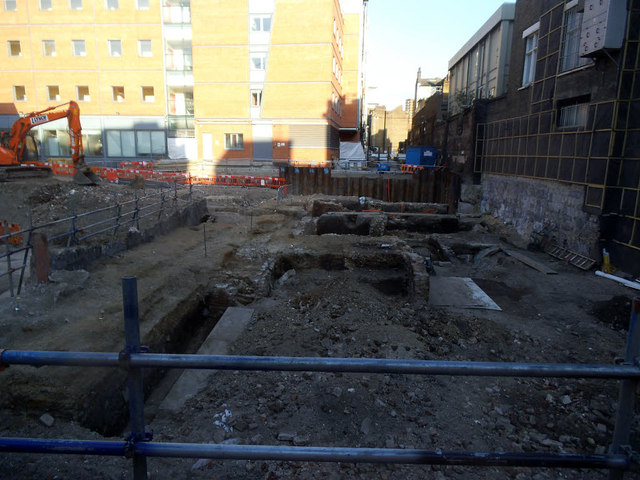
Archaeology on the site of Kentish Buildings (1)
Geograph · CC BY-SA 2.0

This small alley encodes a forgotten bit of London's transport history. The name itself tells the story of coaching routes and Kent traders converging on Borough High Street. But what drew commerce here in the first place was older still—the pilgrimage roads.

✦   ✦   ✦
Name Origin

From Alley to Trading Post

Until the beginning of the 19th century Kentish Buildings was known as Christopher Alley. It occupies the site of the inn yard of the Christopher, an inn marked on the plan of 1542, and probably so named after the patron saint of travellers, Saint Christopher. The current name Kentish Buildings is after 17th century property owner Thomas Kentish. There is a yard entrance on the south which is known as Kentish Buildings, indicating a connection with the County of Kent from where stagecoaches and waggons often came on routes ending at inns along Borough High Street.

The transformation of the street’s name captures the shift from religious pilgrimage to commercial transport. When pilgrims traveled to Canterbury, they gathered at the Christopher. As coach routes became established and Kent traders brought their goods to market at Borough High Street, the yard became known not for a saint but for a proprietor—Thomas Kentish—and by association with the traffic rolling in from his county.

How the name evolved
1542 Christopher Alley
c. 1700–1800 Kentish Court
early 19th cent. Kentish Buildings
✦   ✦   ✦
History

The Canterbury Road Converges

The Christopher Inn stood at a pivotal junction in Southwark’s medieval geography. Pilgrims, as documented in Chaucer’s Canterbury Tales, travelled along the road from London and Southwark on their way to Canterbury. The inn was one of many coaching establishments that made Borough High Street the principal embarkation point for anyone traveling southeastward from the City.

Key Dates
1542
Christopher Inn
First recorded on Southwark map, marking the inn yard that would later become Kentish Buildings.
c. 1700s
Thomas Kentish Era
Property owner Thomas Kentish lends his name to the yard, reflecting Kent trade traffic to Borough High Street inns.
18th century
Georgian Rebuilding
Red brick townhouses of three and four storeys erected, with characteristic sash windows and tiled roofs.
Early 19th cent.
Name Standardized
Christopher Alley formally renamed Kentish Buildings; the earlier reference to the saint falls away.
Did You Know?

The buildings were badly damaged by enemy action but retain the remains of a mid-18th century staircase above first floor level, with a fireplace on the second floor having a bolection moulded surround. These Georgian details survive Blitz damage and modern reconstruction.

By 1840, the Kentish Drovers public house was named because the road was a thoroughfare for market traffic. The roads that had once carried pilgrims now moved livestock, produce, and trade goods. Kentish Buildings—once just an inn yard—had become an architectural witness to that transformation. The ground floor has been reconstructed to form part of the Grapes public-house in Borough High Street.

✦   ✦   ✦
Culture

Patterns in Brick and Glass

Architectural Heritage
Georgian Courtyard Townhouses

The surviving facades along Kentish Buildings represent a rare survival of 18th-century Southwark vernacular. The red brick construction, flush sash windows, and steep pitched roofs are typical of the modest merchant housing built after the Great Fire of 1666 rebuilt the entire district. These houses are not grand, but their materials and proportions tell of careful craft.

According to British History Online, the site preserves evidence of occupation spanning centuries. The two houses here have been occupied together for the last two centuries, and were tenanted by S. Garth Wicking & Co. as a music warehouse. That conversion reflects the 20th-century shift away from residential occupation toward light industrial and storage use—a pattern repeated across South London.

✦   ✦   ✦
Today

A Quiet Corner of the Borough

Kentish Buildings remains understated and easy to overlook. To walk through the narrow arched entry is to step out of the bustle of Borough High Street into a preserved fragment of Southwark’s 18th-century fabric. The cobbles, the brick, the proportions of the court all speak to an earlier mode of urban living—one where an inn yard, a staircase, and a fireplace were the focus of daily life.

The street stands adjacent to Borough Market and the cathedral, embedded in one of London’s most historically layered neighborhoods. Visitors to the market often pass Kentish Buildings without noticing it. Yet the court encodes the routes that made Borough High Street what it was—the convergence of pilgrimage, commerce, and the everyday traffic of goods and travelers that kept medieval and early modern London supplied.

2 min walk
Borough Market
Historic food market open year-round, with pedestrian routes and public courtyards.
3 min walk
Southwark Cathedral Gardens
Tranquil green space with seating and views toward the riverside.
5 min walk
River Thames Embankment
Riverside walks and views toward London Bridge and City of London.
8 min walk
St Mary Overie Dock
Historic riverside mooring with connections to the Liberty of the Clink.
✦   ✦   ✦
On the Map

Kentish Buildings Then & Now

National Library of Scotland — Ordnance Survey 6-inch, c. 1888. Hosted by MapTiler. Modern: © OpenStreetMap contributors.

✦   ✦   ✦

Frequently Asked Questions

Why is it called Kentish Buildings?
Kentish Buildings was named after Thomas Kentish, a 17th-century property owner in the area. The name reflects the presence of stagecoaches and waggons from Kent, which regularly arrived here at coaching inns along Borough High Street. Before the 19th century, the site was known as Christopher Alley, after the Christopher Inn that occupied the inn yard on this spot.
What was the Christopher Inn and when did it operate?
The Christopher Inn was marked on the 1542 map of Southwark and was named after Saint Christopher, the patron saint of travellers. It stood on the site now occupied by Kentish Buildings and served as a coaching inn and stop on the Canterbury pilgrimage route. The inn yard survives today as the narrow court known as Kentish Buildings, preserving the passage that once connected pilgrims and traders with the High Street.
What is Kentish Buildings known for today?
Kentish Buildings is a narrow Georgian court opening into Borough High Street, preserved with 18th-century red brick facades and sash windows. It remains a vital reminder of Southwark’s role as a transport hub where roads to Kent converged and pilgrims departed for Canterbury. The court stands between buildings 121 and 123 and retains its original architectural character despite wartime damage and later reconstruction.