Southwark London England About Methodology
Southwark · SE15 · Peckham

Kelly Avenue

A surname carried forward from Victorian land development—laid out when Peckham’s ancient market gardens were swallowed whole by the expanding metropolis in a single generation.

Name Meaning
Uncertain
First Recorded
c. 1880s
Borough
Southwark
Character
Residential
Last Updated
Time Walk

Market Gardens to Metro Living

Kelly Avenue runs through one of Peckham’s most densely layered residential neighbourhoods—a street of predominantly flat conversions and purpose-built blocks hemmed between Peckham Road and the streets that fan south toward Peckham Rye. The housing stock is a palimpsest: Victorian terrace bones beneath twentieth-century conversions, with newer social housing blocks completing the picture of a place that has been continuously rebuilt around its original street plan.

2010
Kelly Avenue, Peckham
Wikimedia Commons · CC BY-SA 2.0
2018
Kelly Avenue
Kelly Avenue
Wikimedia Commons · CC BY-SA 2.0
2018
View from the Thames Path National Trail near Southwark Bridge
Wikimedia Commons · CC BY-SA 2.0
Today
Kelly Avenue, Peckham
Geograph · CC BY-SA 2.0

Today the street sits within the Peckham ward of Southwark—one of inner London’s most ethnically diverse postcodes, where over half of residents were born outside England. The name on the street sign, “Kelly”, feels unremarkable now. Where it actually came from is a question without a tidy answer.

✦   ✦   ✦
Name Origin

A Surname Borrowed from the Builder’s Ledger

The origin of the name is not recorded in available sources. The name Kelly is one of the most widely distributed surnames in the British Isles—derived from the Irish O’Ceallaigh, meaning “descendant of Ceallach,” a personal name of uncertain ancient meaning, possibly connected to the Old Irish word for “bright-headed” or “strife.” It arrived in England through centuries of Irish migration and was well established in south London by the Victorian era. As documented by British History Online, Victorian street naming in areas like Peckham typically followed one of two conventions: the name of the landowner or developer who laid out the estate, or a name chosen by the local vestry to honour a local figure. Without surviving deeds or vestry minutes confirming which “Kelly” was honoured here, no definitive attribution can be made.

The avenue suffix itself is a telling clue. In late Victorian London, “avenue” was aspirational language—it implied a tree-lined, respectable residential address, a cut above the “street” or “road.” Developers laying out new Peckham streets in the 1880s and 1890s used it deliberately to attract middle-class tenants. Whatever the origin of the Kelly element, the “avenue” designation tells us the builders wanted this to sound like somewhere worth living.

How the name evolved
pre-1880s Agricultural land
c. 1880s–1890s Kelly Avenue (laid out)
present Kelly Avenue
✦   ✦   ✦
History

Orchards, Clay and the Coming of the Suburb

Peckham appears in the Domesday Book of 1086 as Pecheham—a small agricultural holding of two hides, held by the Bishop of Lisieux from Odo of Bayeux. For much of its medieval and early modern history, the land that would become Kelly Avenue was market garden and orchard. As recorded by British History Online, Peckham had extensive market gardens growing produce—including melons, figs and grapes—for the nearby markets of London, with the formal gardens of Peckham Manor House visible on John Rocque’s map of 1746. The workers who tended these plots lived in a scattered village a world away from the dense terraces that would follow.

Key Dates
1086
Domesday Entry
Peckham recorded as Pecheham — agricultural land held by the Bishop of Lisieux from Odo of Bayeux.
1746
Rocque’s Map
John Rocque’s survey shows the Peckham area as predominantly market gardens and orchards. The site of Kelly Avenue is open land.
1826
Grand Surrey Canal
The branch canal to Peckham is completed, enabling timber and materials to arrive cheaply — accelerating the building that will follow.
c. 1851
Suburban Expansion Begins
Housing spreads north and west of Peckham Rye. The land around the future Kelly Avenue shifts from agricultural to development use.
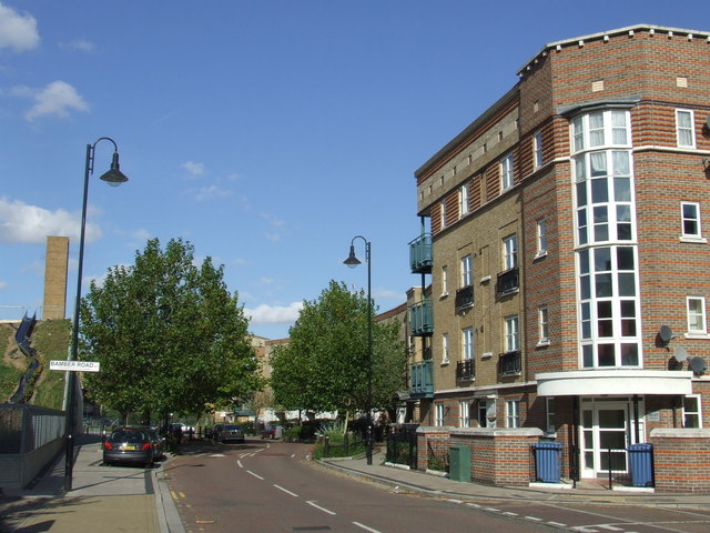
c. 1880s
Avenue Laid Out
Kelly Avenue is laid out as part of the rapid infill of Peckham’s remaining market garden land. Terraced housing follows within a decade.
1940s
Wartime Damage & Post-War Rebuilding
Like much of Peckham, the area around Kelly Avenue suffers bomb damage in the Second World War; post-war social housing replaces some Victorian fabric.
Did You Know?

In 1767, the poet William Blake visited nearby Peckham Rye and reportedly experienced a vision of angels in a tree — an episode that would shape his mystical poetry for decades. The same fields and lanes of Peckham that inspired Blake were being built over with terraces like those of Kelly Avenue less than a century later.

By the mid-nineteenth century, Peckham was undergoing the same transformation sweeping south London. In 1851, Thomas Tilling launched an omnibus service from Peckham to central London—one of the capital’s first reliable suburban bus routes. Rail and road together made Peckham commutable, and builders moved fast. The land immediately around Kelly Avenue, once given over to brick-making as well as horticulture—the London Clay beneath Peckham is ideal for bricks—was platted and sold in job lots through the 1870s and 1880s.

The street was built into a borough already wrestling with the consequences of rapid growth. Drainage, sanitation and overcrowding were persistent problems across Peckham’s new streets in this era. MOLA (Museum of London Archaeology) investigations across Southwark have documented the archaeological layering beneath streets of this type — residues of tile and brick kilns, market garden soil horizons, and the truncated remains of earlier occupation that the Victorian builder’s foundations cut through and sealed. The ground beneath Kelly Avenue almost certainly holds its own such record.

✦   ✦   ✦
Culture

Blake’s Vision and Peckham’s Living Tradition

Peckham’s cultural weight sits disproportionate to its size. William Blake’s vision of angels at Peckham Rye in 1767 made the neighbourhood a site of imaginative significance long before it became synonymous with urban regeneration. The streets laid out in Peckham’s Victorian expansion—including those around Kelly Avenue—absorbed successive waves of migration: Irish communities in the nineteenth century, Caribbean and West African communities from the mid-twentieth century onwards. The result is a neighbourhood whose culture has always been restlessly plural. As SE1 Direct has reported in its coverage of Southwark’s communities, Peckham’s diversity is now one of the defining stories of the broader borough.

Victorian Streetscape
The Avenue as Aspiration

The suffix “avenue” was deliberate marketing in late Victorian south London. Developers laying out streets off Peckham Road in the 1880s used the term to signal a superior class of residential street — wider, potentially tree-lined, aimed at the clerks and tradespeople who formed Peckham’s growing commuter class. Historic England’s guidance on Victorian suburban development in London notes how consistent this naming convention was across inner south London boroughs. The physical fabric of Kelly Avenue — its proportions and plot widths — reflects exactly this aspiration, even where later conversions have changed the individual buildings.

The area around Kelly Avenue sits within a neighbourhood whose post-war social housing was substantially influenced by London County Council design principles of the 1950s and 1960s. Historic England’s records for the wider Peckham area note examples of this LCC housing typology surviving in various states across the ward — a reminder that the twentieth century left its mark on Peckham’s streets just as decisively as the Victorian developer had done eighty years earlier.

✦   ✦   ✦
People

An Unnamed Patron and the Peckham He Built Into

No verifiable individual has been identified who lived or worked specifically on Kelly Avenue, nor has a primary source been found confirming the person for whom it was named. This is not unusual for streets of this tier: the landowners and speculative builders who named Peckham’s Victorian streets were often modest local figures — solicitors, builders, market garden owners — whose names appear in the rate books and trade directories but whose connection to a specific street went unrecorded in surviving documents. The Kelly who gave this avenue its name may have been Irish-born, given the prevalence of that community in south London at the time of the street’s laying-out, or may simply have been a local property owner whose family name the developer chose to preserve.

Peckham itself was home to figures of wider significance during the Victorian era. Thomas Tilling, who transformed London’s bus network by launching his omnibus service from Peckham in 1851 and pioneering pre-arranged stops, built his operation in the same decade that streets like Kelly Avenue were being platted. His work in making Peckham commutable created the very demand that developers were then rushing to satisfy. The connection is structural rather than biographical: without Tilling, there would have been far less incentive to build—and to name—the streets of this neighbourhood.

✦   ✦   ✦
Recent Times

Regeneration, Rye Lane and the New Peckham

Peckham underwent a dramatic reappraisal from the late 1990s onwards. The Peckham Library, opened in 2000 to designs by Alsop & Störmer, announced the neighbourhood’s cultural ambitions to a national audience and became one of the most celebrated public buildings in Britain. The effect on property values and perceptions in streets like Kelly Avenue was gradual but real: a neighbourhood once written off in policy documents as a problem zone became, by the 2010s, one of inner London’s most discussed destinations.

The housing stock of Kelly Avenue itself reflects the pressures of this transition. Census data shows the street and its immediate postcodes contain a higher-than-average level of social housing—around 48% of household spaces—set alongside private conversions and newer purpose-built blocks. This mix of tenures on a single street is characteristic of Peckham’s inner-ring residential fabric: a neighbourhood that gentrified unevenly, leaving the original social housing in place alongside rising property values. Terraced properties on the street have sold for over £600,000 in recent years.

✦   ✦   ✦
Today

Between Peckham Road and the Park

Kelly Avenue sits close to the axis of Peckham Road, within easy walking distance of Harris Academy Peckham, Oliver Goldsmith Primary School, and the Lister Practice GP surgery. The nearest rail connection is Peckham Rye station, approximately 0.4 miles south — the same station that has served the neighbourhood since the railway arrived in the 1860s. The postcode falls within the Peckham ward of Southwark, in the parliamentary constituency of Camberwell and Peckham.

12 min walk
Peckham Rye Park & Common
Over 113 acres of common land and formal park, including a Japanese garden. One of Peckham’s defining open spaces.
15 min walk
Burgess Park
Southwark’s largest park, created from former industrial and residential land; features a lake, BMX track and community gardens.
10 min walk
Warwick Gardens
A compact Victorian neighbourhood park near Peckham Road, popular with local families and dog walkers.
8 min walk
Bellenden Road Green
A small but well-used planted space at the heart of Peckham’s Bellenden neighbourhood, bordered by independent shops.

The street today is a working residential address rather than a destination. Its character — mixed tenures, an ethnically diverse population with a high proportion of residents born outside England — is that of Peckham at its most typical. The name above the street sign remains unresolved, a small puzzle from the building boom that made modern Peckham.

✦   ✦   ✦
Peckham was, at the beginning of the 19th century, a “small, quiet, retired village surrounded by fields.”
Wikipedia, citing contemporary accounts of Peckham Rye, c. 1800
✦   ✦   ✦
On the Map

Kelly Avenue Then & Now

National Library of Scotland — Ordnance Survey 6-inch, c. 1888. Hosted by MapTiler. Modern: © OpenStreetMap contributors.

✦   ✦   ✦

Frequently Asked Questions

Why is it called Kelly Avenue?
The origin of the name is not recorded in available sources. Kelly is one of the most common surnames in the British Isles, of Irish and Anglo-Norman derivation. The avenue most likely takes its name from a local landowner, developer, or person of local prominence involved in the Victorian-era development of this part of Peckham, but no primary document — deeds, vestry minutes, or commemorative record — confirming the specific individual has been identified.
When was Kelly Avenue built?
Kelly Avenue was laid out as part of the rapid Victorian suburban expansion of Peckham in the late 19th century — most likely in the 1880s or 1890s — when the remaining agricultural and market-garden land across Southwark was systematically converted into residential streets. The street’s terraced and later flat-conversion housing stock is consistent with development of this period.
What is Kelly Avenue known for?
Kelly Avenue is a residential street in Peckham, Southwark, within the Peckham ward. It is known today as a mixed residential address — predominantly flats, with a significant proportion of social housing alongside private conversions — close to Peckham Road and within easy reach of Peckham Rye station. The street sits in an area whose history stretches from medieval market gardens and orchards to one of London’s most energetically regenerated inner-city neighbourhoods. Its name remains unexplained by surviving records.