Southwark London England About Methodology
Southwark · SE1

Harris Street

A Victorian terrace row pressed into Peckham’s expanding grid — named, most likely, for a person nobody now remembers.

Name Meaning
Surname-based
First Recorded
c. Late 19th c.
Borough
Southwark
Character
Victorian Residential
Last Updated
Time Walk

Fields to Terraces in a Single Generation

Harris Street stands in Peckham, a neighbourhood whose transformation from rural village to dense Victorian suburb was among the most rapid in all of south London. The street sits within the compact residential grid that filled Peckham’s remaining fields and orchards in the second half of the 19th century, a development driven by the arrival of the railway and the appetite of a new class of urban tenant—artisans, clerks, and tradespeople seeking modest but respectable homes within reach of the City.

The brick terraces that line the street are characteristic of the speculative housebuilding wave that swept across north Peckham from the 1860s onwards. That wave had a name before it had a map, and the name “Peckham” itself is far older than any of these houses. The question of why this particular street bears the name “Harris” is one that the street’s stones do not easily answer.

2008
Southwark Underground Station
Wikimedia Commons · CC BY-SA 2.0
2012
Flickr - Duncan~ - Southwark Street lights
Flickr - Duncan~ - Southwark Street lights — near Harris Street
Wikimedia Commons · CC BY 2.0
2022
Official portrait of Lord Kennedy of Southwark crop 2, 2022
Wikimedia Commons · CC BY 3.0
Today
Flats, Owgan Close, SE5 — near Harris Street
Geograph · CC BY-SA 2.0
✦   ✦   ✦
Name Origin

A Name Without a Face

The name “Harris” in a Victorian street context almost always derives from a surname—typically that of a local landowner, developer, builder, or estate agent with a financial interest in the land at the moment of laying out. The origin of the name “Harris Street” in Peckham is not recorded in available sources. No primary document—estate deed, vestry minute, or council record—has been found that identifies the specific individual commemorated.

Harris was one of the commonest surnames in Victorian London, and streets bearing it appear across many south London boroughs, nearly all of them dating from the speculative building surge of the 1860s–1890s. As the Wikipedia survey of Street Names of Southwark confirms, the dominant pattern in this part of London was for new residential streets to be named after whoever held the freehold or leasehold of the plot at the time of development. Without a documentary source, however, any attribution to a specific “Harris” must remain speculative.

How the name evolved
c. late 19th c. Harris Street
present Harris Street
✦   ✦   ✦
History

From Cattle Droves to Commuter Terraces

Peckham was, for most of its history, a stopping-point on the road between London and the Surrey countryside. The village was the last stopping point for many cattle drovers taking their livestock for sale in London, and the drovers stayed in local inns while the cattle were secured overnight in holding pens. The land that would eventually become Harris Street’s terraces was almost certainly agricultural or horticultural in this period—fields and gardens characteristic of a working Surrey village within sight of the City.

Key Dates
pre-1800
Rural Peckham
The area around what is now Harris Street was open farmland and orchards on the northern fringe of Peckham village, used in part by drovers and market gardeners.
c. 1823
River Peck Enclosed
The River Peck — from which Peckham takes its Saxon name — was enclosed and culverted, removing a significant topographic feature of the pre-suburban landscape.
1865
Railway Arrives
Peckham Rye station opened, connecting the area to the City and docks. The arrival of the railway opened Peckham to artisans and clerical workers, triggering the suburban housing boom.
c. 1865–1890
Terraces Fill the Fields
Speculative builders laid out streets of terraced housing across north Peckham. Harris Street most likely dates from this period, its name reflecting a now-unidentified local landowner or developer.
1965
Southwark Created
The Metropolitan Borough of Camberwell — which had governed Peckham — was abolished when the London Borough of Southwark was created under local government reorganisation.
Did You Know?

“Peckham” is a Saxon place name meaning “the village of the River Peck,” a small stream that ran through the district until it was enclosed in 1823. The street therefore sits within a neighbourhood whose name is more than a thousand years old — far older than any of its Victorian bricks.

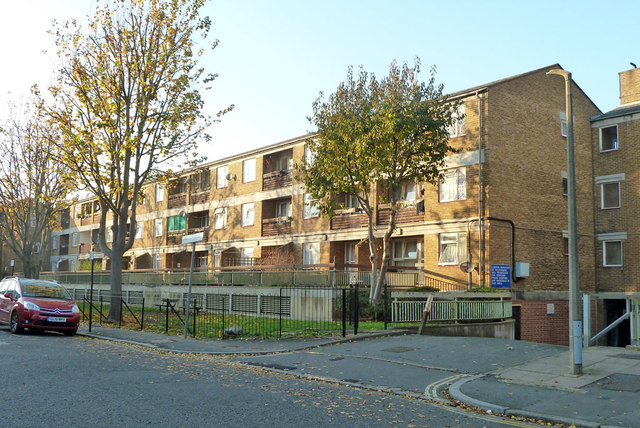
The decisive moment for this part of Peckham was the arrival of the railway. With the introduction of horse-drawn trams about ten years after the railway opened, Peckham became accessible to artisans and clerical staff working in the city and the docks, and housing for this socio-economic group filled almost all the remaining fields. The streets laid out in this period were built quickly and on tight budgets, following a standard pattern of two- and three-storey brick terraces that can still be read in the fabric of the area today.

As documented by British History Online through its Survey of London volumes, the development of south London’s Victorian suburbs was driven overwhelmingly by private speculative builders working on freehold land sold off by estate owners. Streets were named at the builder’s discretion, and the chosen name was rarely recorded alongside any formal explanation. Harris Street almost certainly entered the street directory in this manner: a builder’s choice, noted in a rate book, and never explained thereafter.

✦   ✦   ✦
Culture

The Saxon Village Beneath the Victorian Brick

Peckham’s cultural identity has always been shaped by the tension between its ancient rural character and its rapid, late-Victorian transformation. Archaeological evidence indicates earlier Roman occupation in the area, although the name of this settlement is lost. The ground beneath Peckham’s Victorian streets therefore conceals a far older story. Research published by MOLA (Museum of London Archaeology) has shown that Southwark’s subsoil across many of its residential districts holds evidence of pre-urban occupation, and the Peckham area’s sequence of agricultural use followed by rapid 19th-century development is characteristic of the broader south London pattern.

Saxon Survival
The Name Older Than the Street

The word “Peckham” predates Norman England. It derives from the Old English peāc-hām, meaning the settlement on the River Peck. The Peck was a small stream that ran through the district until it was enclosed in 1823. The Saxon place-name endured through every phase of the neighbourhood’s development, surviving even the rapid erasure of every physical trace of the village it once described. Streets like Harris Street were laid on ground that had been farmed and named for over a thousand years before the first brick was laid.

The historic settlement grew up around Peckham High Street, Peckham Hill Street, and Rye Lane, which still form its main road network. Harris Street and the streets around it were added to this framework in the Victorian period, pressing outward from the old village core as the housing demand of a newly rail-connected suburb outpaced any earlier plan. Historic England’s Historic Area Assessment for central Peckham notes that the neighbourhood’s built environment reflects successive waves of development, from Georgian planned expansion to the dense mid-Victorian terraced housing characteristic of streets like Harris Street.

✦   ✦   ✦
People

Artisans, Clerks, and the Anonymous Builder

No verifiable individual has been found who lived on, worked on, or is commemorated specifically by Harris Street. The street’s likely residents in its early decades were drawn from the social stratum that the railway opened Peckham to. With the arrival of the railway and the introduction of horse-drawn trams about ten years later, Peckham became accessible to artisans and clerical staff working in the city and the docks. These were the people for whom speculative builders constructed streets like Harris Street—anonymous in the historical record, but the defining human fact of the neighbourhood.

The name “Harris” most likely preserves the surname of the developer or freeholder who laid the street out, following the dominant pattern for Victorian south London street naming documented in the SE1 Direct archive of Southwark street histories. Without a rate book entry, estate record, or census return that ties a specific “Harris” to this plot, that individual cannot be identified. The street may commemorate its builder, its landlord, or simply a name thought respectable enough to put above a row of new front doors.

✦   ✦   ✦
Recent Times

Regeneration and Resilience in North Peckham

In 1965, the Metropolitan Borough of Camberwell was abolished and the area then fell roughly within the newly created London Borough of Southwark. This administrative change brought Harris Street within a larger borough whose housing stock faced severe challenges in the post-war decades. North Peckham was heavily redeveloped in the 1960s, consisting mainly of high-rise flats to rehouse people from dilapidated old houses, and was popular on its completion for offering a high quality and modern standard of living.

The Victorian terraces that survived demolition—including many in the streets around Harris Street—have been reappraised in recent decades. What was once considered inadequate housing has been recognised as structurally sound, adaptable, and possessed of the street-level character that post-war tower blocks lacked. The result is a mixed urban landscape in which streets of late-Victorian brick sit alongside the legacies of mid-20th century planning.

✦   ✦   ✦
Today

Peckham’s Living Victorian Grid

Harris Street remains a residential street within one of London’s most culturally diverse neighbourhoods. Peckham is largely regarded as the heart of London’s Nigerian community and draws residents from across the world, layering new communities onto a Victorian street pattern that itself replaced a Saxon agricultural landscape. The street’s brick terraces now house families whose origins span five continents—a demographic transformation unimaginable to the clerks and artisans for whom the houses were built.

The nearest green spaces offer residents respite from the dense urban grain of north Peckham. Each is within easy reach of Harris Street’s SE1 address.

c. 10 min walk
Burgess Park
One of Southwark’s largest parks, covering over 56 acres on the former Surrey Canal route. Lake, sports facilities, and open lawns.
c. 8 min walk
Peckham Rye Park & Common
Historic common land bought by Camberwell vestry in 1868 to preserve it from development. Formal gardens and open common grassland.
c. 12 min walk
Camberwell Green
A traditional London green at the heart of Camberwell, flanked by period buildings and offering a quiet open space within the dense urban fabric.
c. 15 min walk
Nunhead Cemetery
One of the “Magnificent Seven” Victorian garden cemeteries, now a Local Nature Reserve with mature woodland and exceptional views over London.
✦   ✦   ✦
Housing for this socio-economic group filled almost all the remaining fields except the Rye.
Wikipedia — Peckham article, describing the Victorian suburban expansion
✦   ✦   ✦
On the Map

Harris Street Then & Now

National Library of Scotland — Ordnance Survey 6-inch, c. 1888. Hosted by MapTiler. Modern: © OpenStreetMap contributors.

✦   ✦   ✦

Frequently Asked Questions

Why is it called Harris Street?
The origin of the name is not recorded in available sources. The surname Harris was extremely common in Victorian London, and streets of this era in Peckham were most often named after local landowners, developers, or builders who held interests in the land at the time of laying out. No documentary evidence has been found to confirm which individual, if any, the street commemorates.
When was Harris Street laid out?
Harris Street most likely dates from the Victorian suburban expansion of Peckham, which gathered pace from the mid-19th century onwards after the opening of Peckham Rye station in 1865. That event opened the area to artisans and clerical workers from the City and docks, triggering the speculative building boom that filled Peckham’s remaining fields with terraced housing. Ordnance Survey mapping of the late 19th century places Harris Street within the dense residential grid created during this period.
What is Harris Street known for?
Harris Street is a residential street in Peckham, Southwark SE1, typical of the Victorian terraced housing that filled this part of south London following the arrival of the railway in 1865. It sits within a borough whose history encompasses Roman settlement, Saxon place-names, and one of London’s most remarkable 19th-century suburban expansions. Today it lies within one of the capital’s most culturally diverse neighbourhoods, a few minutes’ walk from Burgess Park and the historic market streets of Peckham.