Time Walk
A Passageway Beneath the Railway
Dirty Lane today is a modern development that creates a lane through a series of railway arches built in the 1860s to extend the railway over the Thames to Cannon Street, with spaces between the arches filled with retail shops. The site was redeveloped as Borough Yards, with a new passageway punched through the middle of the railway arches to create a new Dirty Lane. It opens pedestrian routes between Clink Street and Park Street, serving the rapidly changing neighbourhood at the foot of London Bridge.
2023
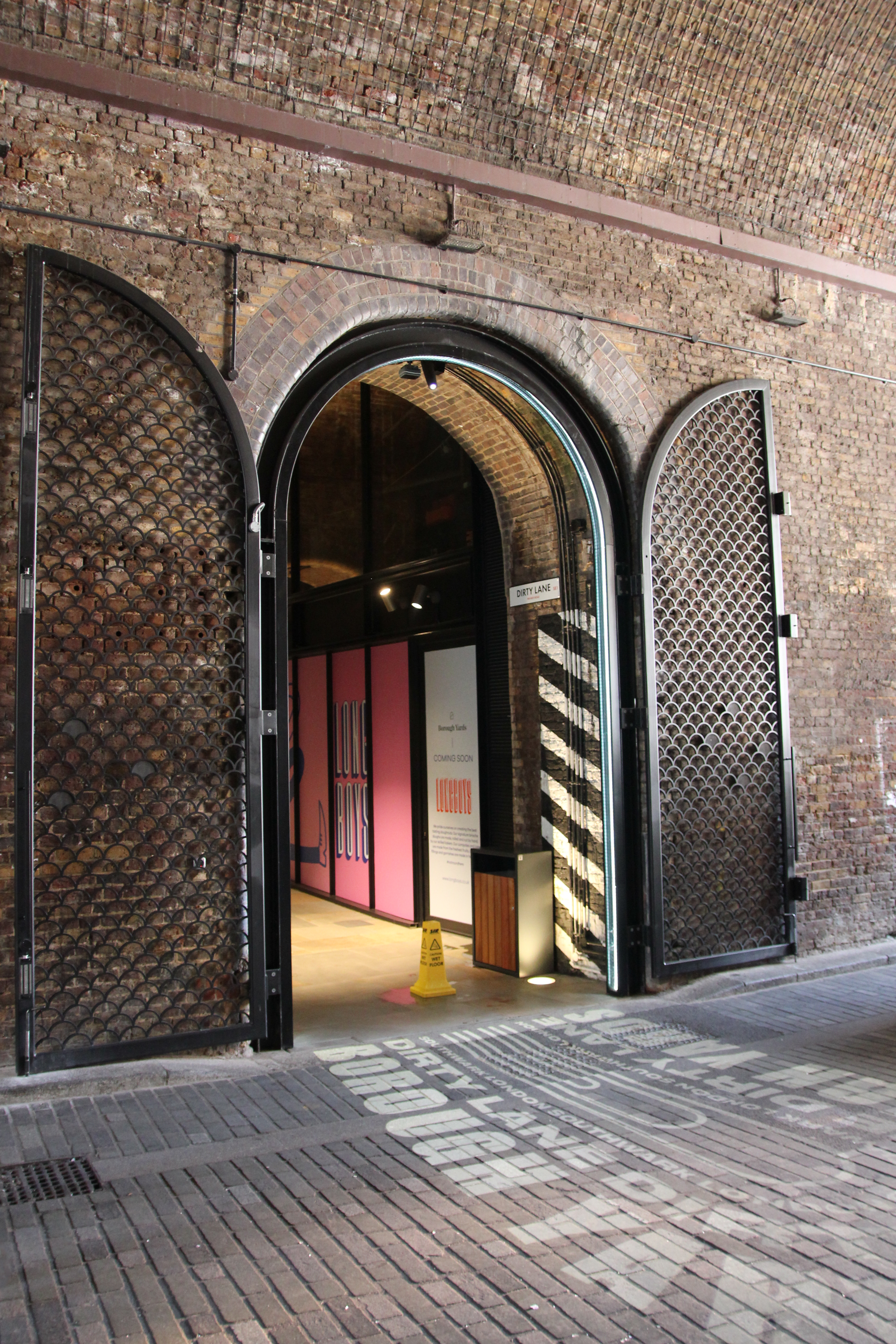
Dirty Lane Gate
Wikimedia Commons · CC BY 2.0
2024

Borough Yards, Dirty Lane
Wikimedia Commons · CC BY-SA 2.0
—
Historical image not found
Today

Borough Market — near Dirty Lane
Geograph · CC BY-SA 2.0
The name, however, belongs to the past. This alley revives a street that thrived centuries before the railways came—and the story begins in an earlier Borough altogether.