Southwark London England About Methodology
Southwark · SE5 · Camberwell

Brisbane Street

Named for the man who gave Australia’s third-largest city its name—a Scottish soldier-astronomer who governed a continent and studied the southern stars.

Name Meaning
Sir Thomas Brisbane
First Recorded
c. 1870s
Borough
Southwark
Character
Victorian residential
Last Updated
Time Walk

Camberwell Brick, Southern Skies

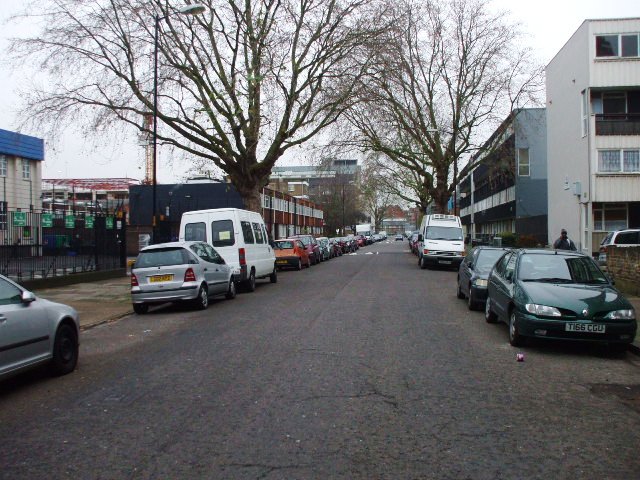
Brisbane Street sits in the flat northern quarter of Camberwell, part of the dense Victorian grid that filled in rapidly once horse trams reached this part of south London in the 1870s. The street runs approximately 200 metres, its terraced housing a testament to the speculative building that transformed open market gardens into working-class London within a single generation. Camberwell Green—the old village common—lies only minutes’ walk away.

1734
Southwark Fair MET DP827006
Wikimedia Commons · CC0
2021
Iron Acton War Memorial Gloucestershire
Wikimedia Commons · CC BY-SA 4.0
Historical image not found
Today
Lomond Grove, SE5 — near Brisbane Street
Geograph · CC BY-SA 2.0

One address on the street preserves a name that belongs to the suffragette movement rather than to any colonial governor: Christabel Pankhurst Court, at No. 25, is a reminder that Camberwell’s housing estates have long honoured reformers as well as empire-builders. The street’s own name, however, points firmly toward the age of empire—and toward a man whose reputation once spanned two hemispheres.

✦   ✦   ✦
Name Origin

The Governor Who Kept the Time of the Army

The origin of the name Brisbane Street is not recorded in available historical sources.

“He kept the time of the army.”
The Duke of Wellington, on Brisbane’s use of astronomy during the Peninsular War
✦   ✦   ✦
History

From Market Garden to Victorian Terrace

Camberwell was for centuries a separate village south of London, known for clean air, medicinal wells and wealthy residents who commuted by carriage to the City. As recorded by British History Online, the parish remained largely rural into the early 19th century, with grand mansions on Denmark Hill and Camberwell Grove co-existing with open farmland. Brisbane Street’s site would have been market garden or open ground until the mid-Victorian building wave swept northward from the village centre.

Key Dates
c. 1870s
Street laid out
Brisbane Street most likely appears during the rapid residential expansion of Camberwell’s northern flatlands, driven by horse trams and population growth.
c. 1894
Area fully built
Ordnance Survey maps from 1894 show the surrounding streets fully developed with terraced housing.
1939–45
Wartime damage
The Second World War hit Camberwell severely; 937 people were killed across the area and nearly all buildings were damaged.
post-1945
Rebuilding
Post-war reconstruction replaces and supplements Victorian housing stock with 20th-century residential development.
Did You Know?

Sir Thomas Brisbane also has a crater on the Moon named after him. He was elected President of the Royal Society of Edinburgh in 1832—succeeding Sir Walter Scott—and received honorary degrees from both Oxford and Cambridge.

The growth that shaped Brisbane Street was driven by population pressure. As recorded by the Southwark Heritage Blog, development to the north of Camberwell’s Church Street was stimulated by the growth of London’s working-class population in the mid-19th century and the coming of horse trams in the 1870s. The area was also surprisingly industrial nearby, with timber yards and mineral water works along the Grand Surrey Canal. By the 1890s the street was fully formed within a dense residential grid.

The Second World War left its mark across Camberwell. Southwark Heritage records show that 937 people were killed across the area and nearly all buildings were damaged, many beyond repair. Post-war rebuilding replaced parts of the Victorian streetscape with 20th-century blocks; today the street presents a mix of surviving period terraces and later residential development, a pattern common across this part of Southwark.

✦   ✦   ✦
Culture

Suffragette Court in a Colonial Street

The most striking cultural tension on Brisbane Street is the juxtaposition of its name’s imperial origins with the address of Christabel Pankhurst Court at No. 25. Christabel Pankhurst was the eldest daughter of Emmeline Pankhurst and co-founder of the Women’s Social and Political Union, the militant suffragette organisation that campaigned for women’s right to vote in the early 20th century. A residential block on a street named after a colonial governor now bears the name of one of Britain’s most prominent campaigners for democratic rights—a small but legible piece of Southwark’s contested history written into its addresses.

Name Within a Name
Christabel Pankhurst Court, No. 25

A residential block within Brisbane Street commemorates Christabel Pankhurst (1880–1958), co-founder of the Women’s Social and Political Union alongside her mother Emmeline. As Historic England and Southwark Council’s blue plaque programme both reflect, south London’s street-level naming has increasingly incorporated women reformers alongside the Victorian colonial figures who once dominated the map.

The wider Camberwell area has long been associated with the arts and intellectual life. The South London Gallery on Peckham Road, the Camberwell College of Arts—part of the University of the Arts London—and the legacy of residents such as John Ruskin on Denmark Hill all contribute to the neighbourhood’s cultural character. Brisbane Street itself sits within this creative quarter, close to the gallery district that has grown around Camberwell Green since the 1990s.

✦   ✦   ✦
People

Soldier, Astronomer, Governor

✦   ✦   ✦
Recent Times

Camberwell’s Long Regeneration

Post-war Camberwell underwent significant change. As the Southwark Heritage Blog records, the Second World War killed 937 people in the area and left nearly all buildings damaged, many beyond repair; much of the Georgian and Victorian architecture was subsequently replaced or supplemented by large 20th-century developments. The mix of period terraces and modern residential blocks that characterises Brisbane Street today reflects that layered history of destruction, replacement and survival. As reported by SE1 Direct, Southwark’s inner neighbourhoods have seen sustained regeneration investment since the 1990s, with housing renewal and improved public realm across Camberwell.

The Camberwell Green ward, within which Brisbane Street sits, has a notably diverse and youthful population. Census data shows a higher-than-average concentration of students, reflecting the proximity of Camberwell College of Arts and King’s College Hospital on Denmark Hill. The street itself remains primarily residential, with a mix of tenures and building ages characteristic of inner south London.

✦   ✦   ✦
Today

Green Spaces at Every Compass Point

Brisbane Street sits within a few minutes’ walk of several green spaces that give this part of Camberwell its community character. Camberwell Green—the former village common that the Victorian era converted from fair ground to public park—is the closest, its farmers’ market and annual fair still drawing the neighbourhood together. Burgess Park, the largest open space in Southwark, lies within easy reach to the north-east, while quieter Victorian gardens offer a more intimate green experience within the ward.

5 min walk
Camberwell Green
The original village common, now a public park with a Saturday farmers’ market and the annual Camberwell Fair.
12 min walk
Myatt’s Fields Park
A 14-acre Victorian park between Camberwell and Brixton, with a wildlife garden and community allotments.
15 min walk
Burgess Park
Southwark’s largest park, created from bomb-damaged Victorian terraces and the former Grand Surrey Canal route.
18 min walk
Ruskin Park
A Victorian park on Denmark Hill with a pergola walk, ornamental gardens and a bandstand, named after the art critic John Ruskin who lived nearby.

Denmark Hill station, approximately 0.7 miles away, provides rail connections into the City and beyond. The street falls within the Camberwell Green ward of the London Borough of Southwark and is maintained as publicly adopted highway under Southwark Council.

✦   ✦   ✦
On the Map

Brisbane Street Then & Now

National Library of Scotland — Ordnance Survey 6-inch, c. 1888. Hosted by MapTiler. Modern: © OpenStreetMap contributors.

✦   ✦   ✦

Frequently Asked Questions

Why is it called Brisbane Street?
Brisbane Street in Camberwell is most likely named after Sir Thomas Makdougall Brisbane (1773–1860), the Scottish soldier, astronomer and Governor of New South Wales from 1821 to 1825. The Australian city of Brisbane was named after him, and streets bearing his name appear in several British towns. The street was most likely laid out during the Victorian era when south London developers frequently honoured colonial-era figures at the height of their fame.
When was Brisbane Street, Camberwell, built?
Brisbane Street was most likely laid out in the mid-to-late Victorian era, consistent with the rapid residential expansion of Camberwell’s northern flatlands during the 1860s–1880s. Development in this part of Camberwell was stimulated by population growth and the coming of horse trams in the 1870s. Ordnance Survey maps from the 1890s show the surrounding area fully developed with terraced housing.
What is Brisbane Street known for?
Brisbane Street is a residential street in Camberwell, Southwark, situated within a dense Victorian grid close to Camberwell Green. Christabel Pankhurst Court at No. 25 commemorates the suffragette leader, giving the street an unexpected feminist counterpoint to its colonial name. The street is within easy reach of Denmark Hill station and several green spaces including Camberwell Green and Myatt’s Fields Park.