Lambeth London England About Methodology
Lambeth · SE11 · Heston

Cromwell Road

A name drawn from one of the most contested dynasties in English history, planted quietly in the streets of a former royal manor.

Name Meaning
Cromwell family
First Recorded
19th century
Borough
Lambeth
Character
Victorian residential
Last Updated
Time Walk

Between the Oval and the Manor

Cromwell Road in Heston, Lambeth sits in one of inner south London’s most historically dense pockets. The Oval cricket ground is a short walk away, Kennington Park’s Victorian green follows nearby, and the flat, grid-like streets speak of a neighbourhood that was open meadow within living memory of the people who first built upon it. The Victorian terraces that line this part of SE11 went up fast, driven by the speculative energy that swept south London from the 1840s onwards.

2018
Cromwell Rd
Cromwell Rd
Wikimedia Commons · CC BY-SA 2.0
Historical image not found
Today
Orchard Road — near Cromwell Road
Geograph · CC BY-SA 2.0

Yet beneath the terracotta brick and the slate roofs lies land that once formed part of the royal Manor of Kennington — territory held by kings, princes, and ultimately the Duchy of Cornwall for centuries. The street name itself reaches back to one of the most famous surnames in English history, and its presence here in Heston is no accident.

✦   ✦   ✦
Name Origin

The Cromwell Shadow over Stockwell

The Cromwell name was not an invention of Victorian street-namers looking to honour a convenient historical figure. It had deep roots in this corner of Lambeth. As recorded in historical surveys of the Stockwell and Kennington district, a substantial old house on the west side of Stockwell Green was long associated with Thomas, Lord Cromwell — Henry VIII’s chief minister and the man who oversaw the Dissolution of the Monasteries. British History Online notes that local accounts identified this as a Cromwell residence, though scholars also acknowledged the connection was difficult to prove conclusively.

Whether the precise house attribution was accurate or embellished tradition, the Cromwell name had been woven into the neighbourhood’s identity long before the street was laid out. When terraced development spread through Heston in the 19th century, the name most likely carried across from this well-known local association. No documentary record of a formal naming decision is known to survive, so the connection must be treated as probable rather than verified.

How the name evolved
pre-16th century Open Manor Land
16th–18th c. Cromwell’s locality (local usage)
19th century Cromwell Road
✦   ✦   ✦
History

Manor, Meadow, and the March of Brick

The land beneath Cromwell Road was part of the Manor of Kennington, one of the most historically significant estates in all of south London. British History Online’s Survey of London records that as late as 1636, the Manor presented “an area of meadow and pasture chequered by drainage channels,” with only scattered buildings. The River Effra divided Kennington from neighbouring Vauxhall, and the low-lying ground around Heston was in constant risk of flooding.

Key Dates
1337
Royal Manor
Edward III grants the Manor of Kennington to Edward the Black Prince, who builds a royal palace near Kennington Cross. The estate passes into the Duchy of Cornwall.
1636
Open Pasture
Survey of London records the Heston area as meadow and pasture with few buildings. The old Cromwell house stands on Stockwell Green, embedded in local memory.
1750
Westminster Bridge
Opening of Westminster Bridge transforms access to south London. Kennington Road is laid out across open fields, triggering the first wave of suburban development.
1789
Development Begins
Building agreements on the Duchy of Cornwall’s Kennington demesne lands initiate systematic suburban expansion, including the laying-out of the Oval and connecting roads.
c. 1840s–1870s
Victorian Terraces
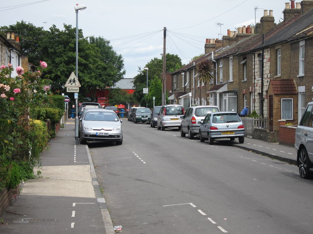
Speculative builders push terraced housing rapidly across Heston and surrounding areas of Lambeth. Cromwell Road takes its name and present form during this period of expansion.
1940
Blitz Damage
Bombing during the Second World War affects parts of inner Lambeth; some properties in the neighbourhood are damaged or destroyed, with subsequent rebuilding reshaping pockets of the area.
Did You Know?

The Manor of Kennington, which encompassed this area of Lambeth, was once the residence of the Black Prince — and the road by which Edward reached his palace from the riverside long retained the name “Princes Road.” The Duchy of Cornwall still owns land in Kennington to this day.

By the early 19th century, the transformation of Lambeth from rural suburb to dense cityscape was well underway. British History Online’s Victoria County History records that between 1801 and 1831 the population of the parish more than trebled. Streets were cut across what had recently been market gardens and nursery ground, their names chosen to honour landowners, military victories, and historical figures already embedded in local legend.

Archaeology across inner Lambeth has revealed layers of occupation beneath the Victorian building line. MOLA (Museum of London Archaeology) fieldwork in the broader SE11 area has identified evidence of drainage systems, brick-earth extraction, and post-medieval land use consistent with the market-garden activity that characterised these streets before development — the physical underside of the pastoral landscape that survives only in historical records.

✦   ✦   ✦
Culture

The Duchy’s Fingerprint

Streets in this part of Lambeth carry the imprint of the Duchy of Cornwall’s centuries-long landholding. The road pattern around Cromwell Road — the oval formation, the communicating streets, the terrace widths — was determined by building agreements made in 1789 between the Duchy and local builders. As Historic England’s records for the Kennington conservation area reflect, surviving Georgian and early Victorian buildings in this neighbourhood represent some of the earliest planned suburban development in south London.

Royal Estate Heritage
The Duchy of Cornwall’s Kennington Legacy

The Manor of Kennington has been held by the eldest son of the reigning monarch since Edward III granted it to the Black Prince in 1337. Every road laid across this land — including those surrounding Cromwell Road in Heston — was developed on ground that still forms part of one of England’s oldest surviving royal estates. The Duchy of Cornwall retains a significant property portfolio in Kennington to this day.

The broader SE11 district developed as a community with its own character — close enough to Westminster to attract professional households, far enough south to remain affordable through the Victorian period. SE1 Direct, which covers the adjacent riverside and Bankside area, has documented how the social geography of this corridor shifted with each generation, from market gardens and working estates to the mixed Victorian residential streets that survive today.

✦   ✦   ✦
People

The Man Behind the Name

Thomas Cromwell — Earl of Essex, chief minister to Henry VIII, and the architect of the English Reformation — is the individual whose family name most likely gives this road its identity. The old house on Stockwell Green associated with him was noted by local historians as early as the 1820s, when it was already described as a relic. Historical surveys record it as "an old house, now in the occupation of a butcher," said to have been where Thomas, Lord Cromwell, lived — though even then, commentators acknowledged the attribution was tradition rather than documentary fact.

Cromwell’s fall was as dramatic as his rise. Trusted as Henry’s instrument for dissolving the monasteries and restructuring the English church, he was arrested in 1540, attainted by Parliament, and executed on Tower Hill on 28 July 1540 — a fate that mirrored many he had engineered for others. That a street in Lambeth should bear his name is a reminder of how deeply the Cromwell legacy — both Thomas and, later, Oliver — embedded itself in London’s topography.

✦   ✦   ✦
Recent Times

Postwar Repair and Inner-City Renewal

Lambeth’s inner streets experienced significant disruption during and after the Second World War. Bombing across SE11 destroyed and damaged properties throughout the Heston neighbourhood, and the postwar decades brought a mixture of council rebuilding schemes and piecemeal private repair. Some Victorian terrace rows were replaced entirely by mid-century social housing blocks; others survived intact and became the basis for later gentrification.

From the 1980s onwards, rising property values in inner London drew renewed investment into the streets around the Oval and Kennington. Victorian terraced houses that had been subdivided into bedsits or let in poor condition were gradually reconverted. The neighbourhood’s proximity to Westminster made it attractive to professional households, and Cromwell Road’s residential character consolidated through that period into the settled, owner-occupied and privately rented stock it presents today.

“The general impression of the Manor at this date is of an area of meadow and pasture chequered by drainage channels.”
Survey of London, Vol. 26 — British History Online, on Kennington Manor c. 1636
✦   ✦   ✦
Today

Heston’s Quiet Residential Core

Cromwell Road today is a residential street embedded in the fabric of Heston, Lambeth — part of a neighbourhood that mixes Victorian terraces with 20th-century infill. The Oval Underground station provides quick access to the City and West End, and Kennington Park remains the area’s principal green lung. The demographic mix of SE11 — long home to professional households drawn by the proximity to Westminster — gives the street a settled, urban residential character.

The nearest green spaces offer relief from the dense street grid. Kennington Park, opened in 1852 on the site of old Kennington Common, is the area’s centrepiece. Archbishop’s Park, on land that formed part of the historic Lambeth Palace estate, provides a quieter garden space close by. For those walking further, Vauxhall Park sits to the west and offers formal planting and open lawns.

10 min walk
Kennington Park
Victorian Grade II listed park opened 1852 on old Kennington Common. Formal gardens, sports facilities, and mature tree canopy.
12 min walk
Archbishop’s Park
Former grounds of Lambeth Palace, now a public park with a community orchard and quiet garden character close to the river.
15 min walk
Vauxhall Park
Formal Victorian park with rose garden, children’s play areas, and miniature model village. Named after the Vauxhall pleasure gardens tradition.
18 min walk
Lambeth Walk Open Space
Small community green adjacent to Lambeth Walk, a pocket park in the heart of the North Lambeth estate.
✦   ✦   ✦
On the Map

Cromwell Road Then & Now

National Library of Scotland — Ordnance Survey 6-inch, c. 1888. Hosted by MapTiler. Modern: © OpenStreetMap contributors.

✦   ✦   ✦

Frequently Asked Questions

Why is it called Cromwell Road?
The name most likely derives from the Cromwell family’s historic association with the Stockwell and Kennington district of Lambeth. Historical accounts recorded an old house on Stockwell Green associated with Thomas, Lord Cromwell — Henry VIII’s chief minister — and the Cromwell name became embedded in this part of south London long before the street was formally named. No documentary record of a council naming decision survives, so the connection is probable rather than definitively verified.
What was the land around Cromwell Road SE11 before it was built on?
Before Victorian development, this part of Lambeth formed part of the royal Manor of Kennington — described in 17th-century surveys as meadow and pasture criss-crossed by drainage channels and subject to regular flooding from the River Effra. The construction of Westminster Bridge in 1750 opened the area to development, and building agreements on the Duchy of Cornwall’s estate from 1789 onwards triggered the systematic expansion of streets through Heston and the surrounding neighbourhood.
What is Cromwell Road SE11 known for?
Cromwell Road is a residential street in the Heston neighbourhood of Lambeth, SE11, sitting within the historic Manor of Kennington — land held by the Duchy of Cornwall since Edward III granted it to the Black Prince in 1337. The wider area is known for the Oval cricket ground, Kennington Park, and its proximity to Westminster, which has long made it attractive to professional residents. The Victorian terraces of the street reflect the rapid suburban expansion that transformed this corner of south London from royal pasture to urban neighbourhood.