Camden London England About Methodology
Camden · NW1

Albany Street

Named after a prince who was the original “Grand Old Duke of York,” this Fitzrovia street was carved out of open farmland in the 1820s by the architect John Nash—and it has never quite lost its Regency ambition.

Name Meaning
Duke of York & Albany
First Recorded
c. 1820s
Borough
Camden
Character
Regency & residential
Last Updated
Time Walk

Regent’s Park at the Kerb

The west side of Albany Street is Crown Estate land—the eastern wall of Regent’s Park’s private world. Stand here and the park is a few metres to your left, the stucco terraces of Nash’s grand scheme rising above the tree line. On the right, the street belongs to Camden: barracks, churches, a former hospital, and a pub that replaced one of Victorian London’s most eccentric structures. Blue plaques appear at intervals, four of them, a higher density of commemorated lives than most London streets manage in a mile.

2007
Albany Street London
Wikimedia Commons · Public domain
2023
79-85 Albany Street, Regent's Park, March 2023
Wikimedia Commons · CC BY-SA 4.0
Historical image not found
Today
Regent's Park, Albany Street Police Station
Geograph · CC BY-SA 2.0

The Melia White House hotel anchors the Marylebone Road end—an Art Deco monolith that was once the most luxurious apartment block in London. From there the street runs north for three-quarters of a mile, changing character as it goes, from Georgian white stucco to Victorian brick to the garrison walls of the barracks. The name that unites it all belongs to a royal prince who died before the street was finished. That name deserves an explanation.

✦   ✦   ✦
Name Origin

The Duke Who Marched Them Up

The street was laid out during the 1820s and takes its name from Prince Frederick, Duke of York and Albany, the younger brother of King George IV. Frederick Augustus was born on 16 August 1763 and died on 5 January 1827. He was created Duke of York and Albany and Earl of Ulster on 27 November 1784. The “Albany” element of his title derived from the ancient Scottish dukedom, traditionally paired with York as the second son’s honour.

Frederick served as Commander-in-Chief of the British Army for many years and was the original “Grand Old Duke of York” in the popular nursery rhyme. He became Commander-in-Chief in 1795 and embarked on reforms that revolutionised the army, taking control of discipline and training troops in drill and field manoeuvres, and ensuring the provision of greatcoats bought with public funds. The street was named in his honour just as the Regent’s Park scheme reached this eastern edge—though Frederick died in January 1827, a year or two before the full length was complete.

How the name evolved
pre-1820s Open farmland / fields
c. 1820s Albany Street & Upper Albany Street
1864 Albany Street (unified)
✦   ✦   ✦
History

Nash’s Boundary, Burton’s Colossus

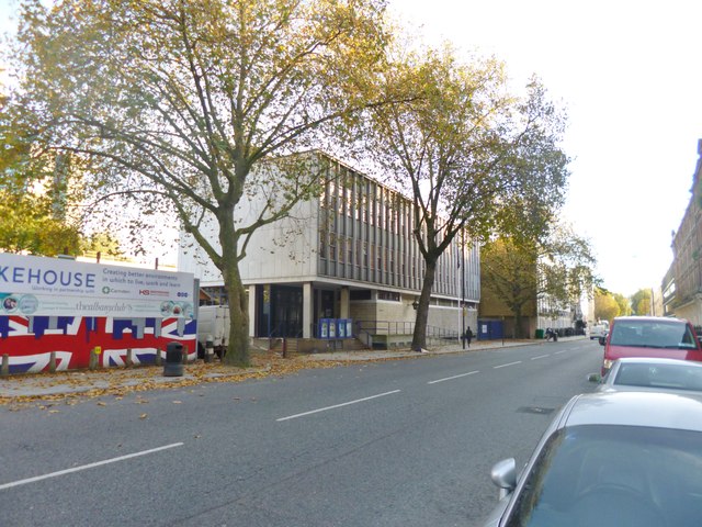
The land that became Albany Street was, until the Regency period, part of the open fields north of London. As recorded by British History Online in the Survey of London, this street was laid out by John Nash to divide the buildings fronting Regent’s Park from the commercial district to the east of it. Nos. 29–33 were originally two houses, the principal front of which faces west into St Andrew’s Place. They were built by George Thompson in 1826 and are among the finest surviving Nash-era frontages on the street.

Key Dates
1818
Ophthalmic Hospital
Nos. 152–154 built as a hospital for soldiers blinded in the Egyptian Campaigns; Sir William Adams served as oculist gratuitously until 1821.
1820s
Street laid out
John Nash lays out Albany Street as the eastern boundary of the Regent’s Park development; building begins under Crown Estate leases.
1826
Nos. 29–33 built
George Thompson constructs the pair of Nash-designed houses with porticoed west fronts; now Grade I listed.
1837
Christ Church built
Sir James Pennethorne’s neo-Grecian church opens on the east side to serve Nash’s new residential district.
1864
Renumbering
Albany Street and Upper Albany Street unified under a single numbering sequence: odd numbers west, even numbers east.
1875
The Colosseum demolished
The vast panorama rotunda between nos. 35 and 55, designed by Decimus Burton, is pulled down after drawing crowds for decades.
Did You Know?

The building at nos. 152–154, originally built as a hospital, was taken over by Sir Goldsworthy Gurney, who here constructed the steam carriage in which he managed to get to Bath and back at fifteen miles per hour. It is also said to have been used as a factory for Perkins and Bacon’s “steam guns,” prototypes of the modern machine gun.

Between nos. 35 and 55, an entire inserted street now occupies the site of the Colosseum—a vast circular rotunda designed by Historic England-listed architect Decimus Burton. The Colosseum housed a panoramic painting of London viewed from St Paul’s dome, which drew enormous crowds from the 1820s onward. Demolished in 1875, it was replaced by “Colosseum Terrace” houses in 1878.

Until 1864, Albany Street and Upper Albany Street were numbered separately, with consecutive numbers in each part. In that year, the whole street was renumbered with odd numbers on the west side and even on the east. The street’s divided identity reflected its dual character: Crown Estate stucco to the west, working commercial Camden to the east.

✦   ✦   ✦
Culture

A Window by Rossetti, a Church at Risk

Christ Church on the east side of the street is one of Fitzrovia’s most quietly remarkable buildings. Designed by Sir James Pennethorne, built in 1837 in neo-Grecian style to serve Nash’s development east of Regent’s Park, with later alterations, it contains a stained-glass window by Dante Gabriel Rossetti—one of very few surviving examples of his work in a London church. The building is currently vacant and is listed Grade II* by Historic England.

Pre-Raphaelite Glass in Peril
Christ Church (now St George’s Cathedral), Albany Street

The former Anglican church holds a stained-glass window designed by Dante Gabriel Rossetti, making it a significant Pre-Raphaelite site. In 2020, Historic England awarded a Covid-19 Emergency Heritage at Risk Response Fund grant for a condition survey of the spire to inform future repairs. The building is now vacant, its future uncertain.

The street also produced one of the Victorian era’s most influential social documents. At no. 55, a blue plaque marks the home of Henry Mayhew, whose London Labour and the London Poor transformed how the Victorian middle classes understood poverty. Further along, at no. 197, another plaque commemorates composer Constant Lambert—a figure central to 20th-century British music, who both lived and died in the house he shared with the painter Isabel Nicholas.

📖 Literature
Various works (plaque association)
W. W. Jacobs · 1863–1943
Blue plaque on Albany Street marking his nearby residence at Gloucester Gate.
· Art
Albany Street
Reginald Grenville Eves · 1930
Painting depicting Albany Street, held in Camden Local Studies Archives.
✦   ✦   ✦
People

Poets, Reformers, and a Misplaced Plaque

Four blue plaques make Albany Street unusual even by London standards. Henry Mayhew, the social researcher whose journalism exposed the lives of London’s street traders and the destitute, lived at no. 55. The poet Christina Rossetti—sister of Dante Gabriel—lived at no. 166 for a couple of years. Composer Constant Lambert lived and died at no. 197 with his wife, the painter and designer Isabel Nicholas, later known as Isabel Rawsthorne.

The fourth plaque belongs to the author W. W. Jacobs—best remembered for the horror story The Monkey’s Paw. Jacobs lived at 15 Gloucester Gate, but the plaque was placed on Albany Street, at the back entrance to his house. The mismatch has never been corrected, leaving Jacobs commemorated on a street he technically did not live on.

✦   ✦   ✦
Recent Times

The White House and a Barracks Reborn

The White House at the Marylebone Road end was built in the 1930s as one of London’s most luxurious apartment blocks—a modernist slab of white Portland stone that broke sharply with the Regency stucco around it. It is now the Melia White House hotel, its apartments long since converted. The building still occupies its own traffic island, as does Holy Trinity Church immediately adjacent.

Regent’s Park Barracks on the east side continued as a working military establishment well into the 20th century, its presence giving the northern reaches of the street a different, more institutional character from the residential south. The freehold of the west side remains with the Crown Estate as part of the Regent’s Park holdings, ensuring the street’s Regency character is protected from wholesale redevelopment.

✦   ✦   ✦
Today

Crown Land, Green Edges

Albany Street today functions as a quiet residential and institutional corridor between Marylebone Road and Gloucester Gate. The Crown Estate ownership of the western freeholds has kept the Regency terraces largely intact; the Grade I listed nos. 31 and 33 remain in residential use. The pub called The Victory now occupies the site where Sir Goldsworthy Gurney once tested steam carriages and—so tradition holds—proto-machine guns.

Regent’s Park is the street’s defining neighbour, accessible at multiple points along the western edge. The park’s formal gardens, boating lake, and open grassland sit within a few minutes’ walk of every address on the street.

Immediate west
Regent’s Park
410 acres of Royal Park with formal gardens, a boating lake, and open-air theatre. The street runs along its entire eastern boundary.
5 min walk north
Primrose Hill
Hilltop park with panoramic views across London; one of the city’s most celebrated vantage points.
10 min walk
ZSL London Zoo
Within Regent’s Park, London Zoo has operated since 1828—one of the oldest scientific zoos in the world.
Inner Circle
Queen Mary’s Gardens
Home to over 12,000 roses and the Open Air Theatre; accessed from the park’s central circle directly opposite the street.
✦   ✦   ✦
On the Map

Albany Street Then & Now

National Library of Scotland — Ordnance Survey 6-inch, c. 1888. Hosted by MapTiler. Modern: © OpenStreetMap contributors.

✦   ✦   ✦

Frequently Asked Questions

Why is it called Albany Street?
Albany Street takes its name from Prince Frederick, Duke of York and Albany (1763–1827), the younger brother of King George IV. The street was laid out during the 1820s as part of John Nash’s Regent’s Park development scheme. Frederick held the dual title “Duke of York and Albany”—Albany being the ancient Scottish dukedom traditionally granted to the second son of the monarch alongside the York title.
Who designed the buildings on Albany Street?
John Nash was the principal architect responsible for the street, having laid it out himself as the eastern boundary of his Regent’s Park scheme. Numbers 31 and 33 are Grade I listed buildings designed by Nash and built by George Thompson in 1826. Christ Church on the east side was designed by Sir James Pennethorne and built in 1837. The former Colosseum rotunda, demolished in 1875, was the work of Decimus Burton.
What is Albany Street known for?
Albany Street is known for its fine Regency architecture, its position along the eastern edge of Regent’s Park, and an exceptional concentration of blue plaques. Social reformer Henry Mayhew, poet Christina Rossetti, composer Constant Lambert, and author W. W. Jacobs are all commemorated here. The former Christ Church contains a stained-glass window by Dante Gabriel Rossetti and is listed as a Heritage at Risk building by Historic England. The pub called The Victory occupies the site of a workshop where Sir Goldsworthy Gurney built his pioneering steam carriages in the 1820s.